
Lake Manyara National Park Guide
Tree-climbing lions, elephant-filled forest, flamingo shallows and a Rift Valley road trip in one compact park. This 2026 guide focuses on how to actually plan Lake Manyara: where to drive, what the headline fee covers, which habitats matter and how it fits the Northern Circuit.
Information checked 5 September 2026Lake Manyara at a glance
Lake Manyara National Park is best treated as a compact habitat safari rather than a Big Five checklist. The attraction is the rapid change from spring-fed groundwater forest to acacia woodland, floodplain, papyrus wetland, alkaline lake edge and the steep Great Rift Valley escarpment. TANAPA lists the park at about 648.7 km².
Quick Answers
Best time to visit Lake Manyara
For a classic first safari, June to October is the easiest window. Tracks are generally drier, vegetation is less dense and animal detection improves. November to May brings greener scenery, migrant birds and more changeable road conditions. Because Lake Manyara is strongly influenced by rainfall and lake level, there is no single month that guarantees flamingos or a specific shoreline position.
Best all-round choice for easier driving, clearer sightings and dry-season safari combinations.
Green landscapes, active birdlife and dramatic skies; short rains can alter track conditions.
Lush and atmospheric, but heavy rain can make some southern or low-lying tracks slower or temporarily unavailable.
Lake Manyara fees: what should you budget?
The headline TANAPA conservation fee is only one part of the trip budget. TANAPA’s current Lake Manyara page displays USD 70 for an international adult, USD 20 for an international child and TZS 20,000 for East African residents. Separate vehicle, camping, special-activity and tax components can apply, so use the live TANAPA tariff when paying.
| Item | Current planning figure | What to know |
|---|---|---|
| International adult conservation fee | USD 70 | Displayed on TANAPA’s current Lake Manyara page; verify taxes and current tariff at booking. |
| International child | USD 20 | Use TANAPA’s tariff for the current age definition. |
| East African resident | TZS 20,000 | Carry the documentation required for the applicable category. |
| Vehicle / guide / activity | Additional | Depends on vehicle category and activities such as night drives, walks or canopy experiences. |
Which area of Lake Manyara should you focus on?
Most first-time visitors should enter at the north gate, spend the morning in the groundwater forest and northern wetland zone, then push south only if time and road conditions allow. The park is long and narrow: driving all the way to the southern hot-spring sector turns a short-looking map into a full-day plan.
| Area | Best for | Main access | Planning note |
|---|---|---|---|
| North gate + groundwater forest | Elephants, baboons, blue monkeys, forest birds | Mto wa Mbu / main gate | Ideal first-hour habitat; dense vegetation rewards slow driving. |
| Hippo Pool / northern wetland | Hippos, waterbirds, open views | North-central tracks | Good contrast after forest; use designated viewpoints only. |
| Central woodland / Endala side | Giraffe, elephant, woodland birds, scenery | Internal park tracks | Useful transition habitat between the north and southern lake edge. |
| Maji Moto / southern sector | Hot springs, boardwalk, Rift Valley geology | Longer southbound drive | Allow a full day; seasonal road conditions matter. |
| Escarpment / outside-park viewpoints | Panorama and lake-basin scale | Karatu / escarpment road | Best as an arrival/departure complement rather than replacing a game drive. |
Getting there
TANAPA describes Lake Manyara as roughly 125 km, around 2–2.5 hours by road from Arusha under normal conditions. Lake Manyara Airport sits close to the northern end of the park and is useful for scheduled or charter safari connections. Mto wa Mbu is the practical gateway town for fuel, food and cultural visits before or after the park.
Lake Manyara safari map
This map is for orientation, not turn-by-turn navigation. Exact public coordinates are used for the north and south gates, Lake Manyara Airport and the Maji Moto boardwalk where reasonably verifiable. Other internal facilities follow TANAPA’s published facility map and are deliberately labelled approximate.
A practical one-day Lake Manyara drive
Enter early, use the forest before traffic builds, and only commit to the far south if you have enough daylight to return comfortably. Lake Manyara rewards patience more than distance.
After formalities at the north gate, drive slowly through the spring-fed forest. Look for elephants stepping through shade, olive baboons on the road edge, blue monkeys above and hornbills in the canopy.
Shift toward Hippo Pool and the open floodplain. Scan water margins for hippo, buffalo, waterbuck and large waders; keep binoculars ready for distant flamingos.
Use the central acacia and woodland tracks. This is better giraffe country and one of the habitats where lion sightings are possible.
If rain, road conditions or time are against you, stay north/central. If conditions are good and you have a full day, continue toward Maji Moto.
The boardwalk and hot-spring flats add geology and wide lake-edge views. Do not treat the water as a bathing attraction unless current park rules explicitly allow it.
TANAPA currently says gates close at 18:00. Build in substantial return time rather than relying on map distance alone.
Mammals of Lake Manyara
Manyara’s strength is habitat diversity. The forest, woodland and wetland mix means a relatively short drive can produce primates, elephants, plains game and aquatic mammals. Lions are famous here, but sightings are never guaranteed.
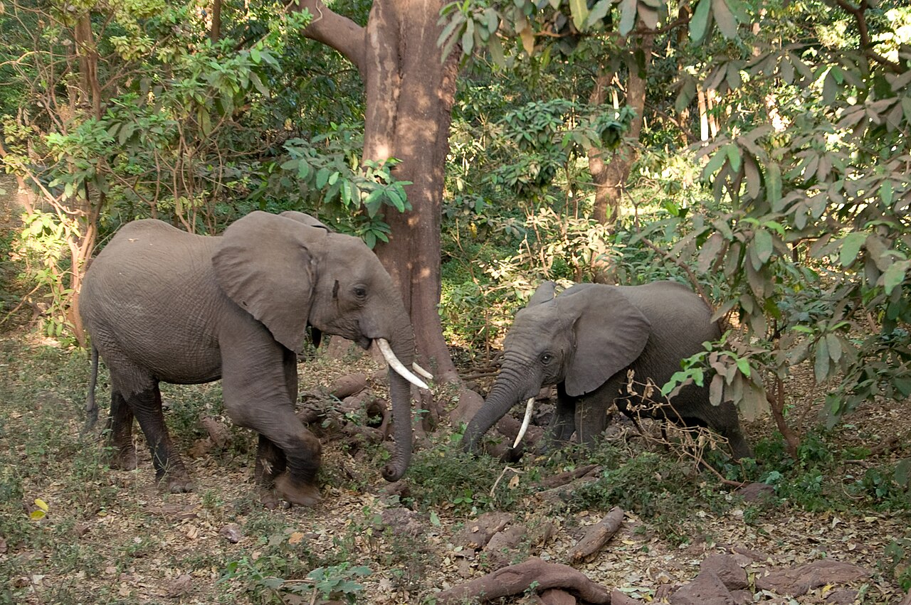
Large family groups use forest, woodland and open margins. In dense vegetation, stop early and give them room rather than squeezing past.
Lake Manyara is famous for lions resting in trees, but tree-climbing is a behavior, not a scheduled attraction. Scan large horizontal limbs and shaded woodland edges.
Secretive and easy to miss in thick cover. Early/late light and woodland edges offer the best chance.
Often around floodplains, marsh margins and muddy areas. Older bulls may spend long periods near wet ground.
Look in acacia woodland and more open central habitats; the irregular, leaf-like coat pattern is distinctive.
More likely in open grassland and floodplain than dense forest. Often mixes with wildebeest.
Use the open plains and grazing areas. Manyara is not a migration spectacle, but local herds are part of the park’s plains-game mix.
Hippo Pool and reed-fringed water are the obvious places to look. Stay only at designated viewing areas.
Large troops are a signature sight, especially around the northern forest and road verges. Never feed them.
Watch the mid-canopy in the groundwater forest. Their dark cap and grey-blue coat separate them from vervets.
Often around woodland edges and visitor areas. Secure food and bags where primates are habituated to people.
A forest-edge antelope that can appear suddenly in dense cover. Look for white spotting and cautious movement.
Use woodland and open edge habitat. Rutting males are especially conspicuous when vocal and territorial.
Favor wetter grassland and reed margins. Look for the shaggy coat and broad pale rump marking.
Seen on shorter grass and road margins. Families often trot away with tails held upright.
Social groups forage rapidly through open woodland, termite areas and lodge surroundings.
Tiny, pair-living antelope of thicket and bush. They are easiest to miss when you drive too fast.
More likely around open habitats or in low-light hours; tracks and calls may be more frequent than daytime sightings.
A slender spotted carnivore that is more realistic on authorized night activities than a standard day drive.
Usually detected by tracks, quills or night sightings rather than a normal daytime safari.
Birds to look for
Lake Manyara is one of the easiest Northern Circuit parks to make birding central to the day. TANAPA states that more than 400 bird species occur across lake, wetland, forest and woodland habitats. Flamingos are seasonal and should never be marketed as guaranteed.
Can form striking pink lines across alkaline shallows when lake chemistry and feeding conditions are right.
Larger and paler than the lesser flamingo, often mixed in smaller numbers.
Watch for large white formations gliding over the lake or resting in open shallows.
The ringing call is often the first clue. Scan tall trees around water margins.
Feeds by sweeping an open bill through shallow water; often alongside egrets and spoonbills.
A very large black-and-white stork with a red, black and yellow bill, associated with wetland margins.
Brown, hammer-headed waterbird seen around pools, streams and marsh edges.
Large forest hornbill with a heavy casque; listen for wingbeats moving through the canopy.
Huge terrestrial hornbill of open woodland and grassland; groups forage slowly on the ground.
Wet grassland and marsh-edge species, unmistakable with its golden crown.
Often uses exposed branches in drier woodland, making it an easy beginner identification.
Feeds by sweeping its flat spoon-shaped bill through shallow water in broad arcs.
Flora: forest, woodland and wetland
The vegetation change is one of Manyara’s defining experiences. Species identification can be difficult from a moving vehicle, so the entries below are field cues rather than a substitute for a botanist or ranger.
Trees & shrubs
Large figs thrive where groundwater is reliable and feed birds, monkeys and other wildlife.
Often associated with groundwater and wetter valley-floor habitats.
Distinctive pale trunks occur in moist Rift Valley settings; exact acacia identification can vary locally.
Thorn woodland opens south of the dense forest and supports giraffe, impala and woodland birds.
Huge water-storing trunks appear in drier southern areas and are a conspicuous landscape feature.
TANAPA notes the Maasai name “Emanyara” as the source of the park’s name.
Dry woodland shrubs add aromatic, open-bush structure away from the spring-fed forest.
Part of the dense spring-fed entrance forest; specific species can be difficult to distinguish at road speed.
Classic flat-topped silhouettes in more open woodland and grazing habitat.
Streams and spring lines support taller, cooler vegetation than the surrounding dry bush.
Reeds, grasses & understory
Dense stands mark permanent or semi-permanent wetland habitat and shelter waterbirds.
Reed margins are important cover around hippo and wetland zones.
Seasonally productive grazing areas draw zebra, wildebeest and buffalo.
Alkaline soils create sparse, specialized vegetation near the soda-lake margin.
Common around spring-fed and marshy ground, providing structure for small birds and invertebrates.
Moist shaded understory can support ferns uncommon in the drier surrounding savanna.
Lianas and climbers contribute to the closed, layered feel of the groundwater forest.
Algal productivity is central to the food web that can support large flamingo concentrations when conditions align.
Short-lived green growth responds rapidly to rain on floodplain and woodland edges.
Wet-season flowers attract insects and add color around springs and drainage lines.
Best things to do in Lake Manyara
The core activity. Drive slowly enough to read the habitat rather than racing from “sighting” to “sighting.”
Bring binoculars and spend real time at wetlands, forest edge and open lake viewpoints.
A scenic southern stop that adds geothermal Rift Valley context to the wildlife day.
TANAPA lists canopy experiences among park attractions; confirm operating times and separate charges before planning around it.
TANAPA lists night game drives where permitted. These are regulated activities, not ordinary self-drive extensions after closing time.
Only where currently authorized and guided under park rules. Never improvise a walk from a roadside stop.
Useful before or after the park for food, markets, local guides and cultural activities.
Escarpment viewpoints outside the park help explain the basin before or after the game drive.
Pair Manyara with Tarangire and Ngorongoro; add Serengeti when itinerary length allows.
Rules and safety
Follow TANAPA signs and ranger instructions over any online guide. Stay in the vehicle except at designated points, never feed baboons or monkeys, keep a respectful distance from elephants and hippos, and do not approach lions even if they are resting in trees.
Keep noise low near bird roosts and wetland margins, take all litter out, and do not use drones or professional filming equipment without checking current permit requirements. If you are self-driving, keep enough fuel and water to absorb delays and return to the gate with daylight margin.
Lake Manyara FAQ
Is Lake Manyara National Park worth visiting?
Yes if you value habitat diversity, elephants, primates, birds and a compact Northern Circuit stop. If your only objective is maximum big-cat density, Serengeti or Ngorongoro may deserve more time.
Can you see tree-climbing lions at Lake Manyara?
Yes, the park is famous for the behavior, but a sighting is never guaranteed. Lions may be on the ground, in thick cover or outside the area you drive.
How much is Lake Manyara entry in 2026?
TANAPA’s current park page displays USD 70 for an international adult and USD 20 for an international child. Check the live tariff for taxes, vehicle fees, activity fees and category definitions.
How long do you need in Lake Manyara?
One full day is ideal for a first visit. A half day can cover the northern forest and wetland zones, but usually does not leave enough time for the far southern hot-spring area.
Can I self-drive Lake Manyara?
Yes, subject to current park rules and road conditions. Use a current map from the gate, stay on permitted tracks and do not treat online route lines as navigation-grade.
What is the best month for Lake Manyara?
June through October is the simplest general recommendation for dry-season wildlife viewing. The green season is excellent for scenery and birds, while rainfall can make some tracks slower.
Are flamingos always at Lake Manyara?
No. Flamingo abundance changes with lake depth, salinity, algae and broader regional conditions, so large flocks are seasonal and variable.
How does Lake Manyara fit with Tarangire and Ngorongoro?
Very naturally. Many travelers use Manyara as a one-day link between Tarangire and the Karatu/Ngorongoro area before continuing toward Serengeti.
Primary sources & live checks
See.Africa checked time-sensitive park information on 5 September 2026 against Tanzania National Parks (TANAPA) pages and the TANAPA facility map. Fees, activities and road access can change. Current gate notices and ranger instructions override approximate map positions or general planning advice.