

Golden Gate Highlands National Park Guide
Explore Golden Gate Highlands with a detailed map, sandstone walks, wildlife, dinosaur interpretation, camps, fees and practical Clarens travel advice.
Sandstone mountains and grassland in Golden Gate Highlands National Park. Photo: Bobbyshabangu · CC BY 4.0. Resized and cropped for this layout.

Golden Gate Highlands National Park at a glance
Golden Gate Highlands is a mountain landscape to explore at a walking and watching pace. Sandstone cliffs rise above grassland, antelope graze on the slopes and changing light gives the rock a different character through the day. It suits a two- or three-night visit built around suitable hikes, scenic drives, birds and interpretation. The Kgodumodumo Dinosaur Interpretation Centre adds a substantial family and educational reason to stop, while the Basotho Cultural Village offers a separate cultural experience. Clarens is a useful outside base, but accommodation inside the park makes early starts and evening light easier to enjoy.
Official sources · checked 9 September 2026: SANParks: Golden Gate Highlands National Park overview · SANParks: current visitor notices. Confirm arrangements for your travel date.
When is the best time to visit Golden Gate Highlands?
Autumn often offers attractive light and comfortable walking conditions, while spring brings new growth and changing weather. Summer can be green and warm, with afternoon thunderstorms that call for early starts and flexible hiking plans. Winter can be cold, frosty and occasionally snowy; a clear day does not remove the need for warm layers. The mountains can become windy or misty at any time. Choose your highest or longest outing for the most suitable weather window, and keep a short walk or interpretation visit as an alternative. Check the route at reception and turn back before deteriorating weather makes the return difficult. A summit photograph is not worth extending a walk beyond the group’s ability.
Typical seasonal pattern, not a forecast or a guarantee of road access. Current local conditions take priority.
Which Golden Gate Highlands area suits your trip?
| Area | Best for | What to expect | Planning point |
|---|---|---|---|
| Glen Reenen and Brandwag | A first base and shorter walks | The central visitor area gives access to familiar sandstone scenery and walking options. | Choose routes using the current map; some viewpoints require a steeper or more exposed approach than expected. |
| Blesbok and Oribi loops | Scenery and grassland wildlife | A vehicle outing can complement walking and suit a mixed-ability group. | Stop only where safe and permitted; animals can be beyond the first visible ridge. |
| Higher trails and Wodehouse country | A more demanding mountain day | Elevation and longer distances make preparation important. | Ask about route condition, estimated time and weather; a peak pin is not a trailhead. |
| Basotho Cultural Village and eastern grassland | Cultural interpretation and a different landscape | The eastern side provides a distinct reason to explore beyond the main camp. | Confirm the current programme, admissions and reporting arrangements. |
| Kgodumodumo centre | Dinosaur interpretation and a weather alternative | A dedicated attraction adds context to the region’s fossils and deep history. | Check the centre’s own ticket rules and opening time. |
| Clarens | An outside accommodation and supply base | Town services can support a park visit without staying in a rest camp. | Allow the daily road approach and avoid beginning a long hike late. |
Golden Gate Highlands entry fees, permits and opening hours
These are daily conservation fees per person for 1 November 2025–31 October 2026, as displayed by SANParks when reviewed. Adult rates apply from age 12; child rates apply at ages 2–11. Bring the identity or residency documents needed for your category and a payment card. Accommodation, guided activities and any equipment or transport are separate. A 1% community fund is added to accommodation and activity reservations. If you hold a Wild Card, check that its membership category covers the park and all travellers; bring the current membership confirmation and identification. For visits from 1 November 2026, use the next tariff rather than extending these prices.
| Visitor category / section | Adult | Child (2–11) |
|---|---|---|
| South African citizens and residents | R73 | R37 |
| SADC nationals | R149 | R74 |
| Other international visitors | R325 | R163 |
Official sources · checked 9 September 2026: SANParks: current conservation fees · SANParks: current visitor notices. Confirm arrangements for your travel date.
Opening hours
SANParks explains that the public road through Golden Gate has no closing boom gates. Visitor control is handled at the Golden Gate Hotel and Glen Reenen receptions on arrival. This is not 24-hour permission for every attraction or trail: confirm reception, centre, cultural-programme and hiking arrangements, and plan to finish outdoor activities with a comfortable daylight margin.
Official sources · checked 9 September 2026: SANParks: current visitor notices · SANParks: entrance hours · SANParks: access and directions. Confirm arrangements for your travel date.
How do you get to Golden Gate Highlands?
Use the R712 approach appropriate to your itinerary, commonly via Clarens from the west or the eastern Free State road network. Treat current road information as more useful than an old estimate of driving time. Refuel before entering: the live notice reviewed still lists Glen Reenen’s filling station as closed until further notice. Buy the provisions required for self-catering or camping and carry water for the planned walks. Check how to reach Highlands Mountain Retreat or any more secluded accommodation, especially after bad weather. If arriving from Gauteng or another distant base, avoid combining the transfer with a long exposed hike. A shorter first walk leaves time to learn the conditions and settle into the altitude and temperature.
Official sources · checked 9 September 2026: SANParks: current visitor notices · SANParks: access and directions. Confirm arrangements for your travel date.
Golden Gate Highlands map: 26 useful places
Use this map to compare bases and understand the landscape. Search by place or filter by type. All locations are approximate orientation points; current park, guide and lodge directions override the map.
Loading map near this section. All places are also listed below.
All 26 map places and access notes
- Glen Reenen Rest Camp · Camps & lodgesAccommodation reference. Book ahead and obtain the correct reception, arrival route and current facilities from the operator. Map source. Approximate.
- Golden Gate Hotel · Camps & lodgesAccommodation reference. Book ahead and obtain the correct reception, arrival route and current facilities from the operator. Map source. Approximate.
- Reception · Gates & visitor centresVisitor access point. Confirm the correct entrance, current hours and onward directions before arrival. Map source. Approximate.
- Kgodumodumo Dinosaur Interpretation Centre · Gates & visitor centresVisitor access point. Confirm the correct entrance, current hours and onward directions before arrival. Map source. Approximate.
- Basotho Cultural Village · Camps & lodgesAccommodation reference. Book ahead and obtain the correct reception, arrival route and current facilities from the operator. Map source. Approximate.
- Dolerite Dyke · ViewpointsUse the designated viewpoint or hide only when open. Follow the current visitor route and keep clear of edges and wildlife. Map source. Approximate.
- Sandstone Valley viewpoint · ViewpointsUse the designated viewpoint or hide only when open. Follow the current visitor route and keep clear of edges and wildlife. Map source. Approximate.
- Drakensberg View Point · ViewpointsUse the designated viewpoint or hide only when open. Follow the current visitor route and keep clear of edges and wildlife. Map source. Approximate.
- Protea Corner · ViewpointsUse the designated viewpoint or hide only when open. Follow the current visitor route and keep clear of edges and wildlife. Map source. Approximate.
- Boskloof · Areas & trail referencesLandscape or trail reference. This pin is not a trailhead or a verified route; obtain the current authorised map and advice. Map source. Approximate.
- Meriting Picnic Site · Areas & trail referencesLandscape or trail reference. This pin is not a trailhead or a verified route; obtain the current authorised map and advice. Map source. Approximate.
- Brandwag buttress · ViewpointsUse the designated viewpoint or hide only when open. Follow the current visitor route and keep clear of edges and wildlife. Map source. Approximate.
- Rooidraai · ViewpointsUse the designated viewpoint or hide only when open. Follow the current visitor route and keep clear of edges and wildlife. Map source. Approximate.
- Generaalskop Viewpoint · ViewpointsUse the designated viewpoint or hide only when open. Follow the current visitor route and keep clear of edges and wildlife. Map source. Approximate.
- Echo Ravine · Areas & trail referencesLandscape or trail reference. This pin is not a trailhead or a verified route; obtain the current authorised map and advice. Map source. Approximate.
- Mushroom Rock · Areas & trail referencesLandscape or trail reference. This pin is not a trailhead or a verified route; obtain the current authorised map and advice. Map source. Approximate.
- Langtoon Dam Viewpoint · ViewpointsUse the designated viewpoint or hide only when open. Follow the current visitor route and keep clear of edges and wildlife. Map source. Approximate.
- Zuluhoek lookout point · ViewpointsUse the designated viewpoint or hide only when open. Follow the current visitor route and keep clear of edges and wildlife. Map source. Approximate.
- Red Mountains · ViewpointsUse the designated viewpoint or hide only when open. Follow the current visitor route and keep clear of edges and wildlife. Map source. Approximate.
- Vulture Hide · ViewpointsUse the designated viewpoint or hide only when open. Follow the current visitor route and keep clear of edges and wildlife. Map source. Approximate.
- Wodehouse Kop · Areas & trail referencesLandscape or trail reference. This pin is not a trailhead or a verified route; obtain the current authorised map and advice. Map source. Approximate.
- Gladstone Dam Lookout Point · ViewpointsUse the designated viewpoint or hide only when open. Follow the current visitor route and keep clear of edges and wildlife. Map source. Approximate.
- Langtoon Dam · Water featuresGeographic water-feature reference, not a launch, swimming or direct driving destination. Use only authorised visitor access. Map source. Approximate.
- Highlands Mountain Retreat · Camps & lodgesAccommodation reference. Book ahead and obtain the correct reception, arrival route and current facilities from the operator. Published facility coordinate; approximate orientation only. Map source. Approximate.
- R712 western park approach · Gates & visitor centresWestern approach on the public R712. Park visitor reporting and fees remain separate from through-road access. Map source. Approximate.
- R712 eastern park approach · Gates & visitor centresEastern approach on the public R712. Confirm where to report for your booked visitor activity or accommodation. Map source. Approximate.
Map references include official park material where specified below, plus OpenStreetMap contributors, checked 9 September 2026. Selected and labelled by See.Africa. Waterbody-centre pins and summits are geographic references, not destinations for direct navigation. Accommodation and airstrip operation must be confirmed. No live animal locations or verified driving route is shown.
A practical Golden Gate Highlands itinerary
One day: one walk and one contrast
Report as required, choose a suitable short route and allow time for a scenic drive or the dinosaur centre. Do not assume every named trail fits between breakfast in Clarens and a late road departure.
Two nights: sandstone and grassland
Use the arrival afternoon for an easy local introduction. Spend the full day on a properly planned walk in the best weather window, then watch grassland animals from an approved road. Keep the departure morning short and flexible.
Three nights: add interpretation
Give the cultural village or dinosaur centre its own unhurried visit. A second outdoor day allows a different route without forcing a long walk in poor weather. This balance works well for families with varied interests.
A hiking-focused visit
Choose the route around the slowest walker, likely weather and a firm turnaround time. Carry water, food, navigation and warm or waterproof layers. Ask about access, permits and current conditions for longer or overnight trails before committing.
Where should you stay in Golden Gate Highlands? Our top 3 nearby stays
For an Expedia-bookable base near the park, these are three useful choices in the Clarens and R712 area. They are outside Golden Gate Highlands National Park; park-run cabins and campsites are booked separately through SANParks. Compare our Top 10 places to stay near Golden Gate Highlands for more choices.
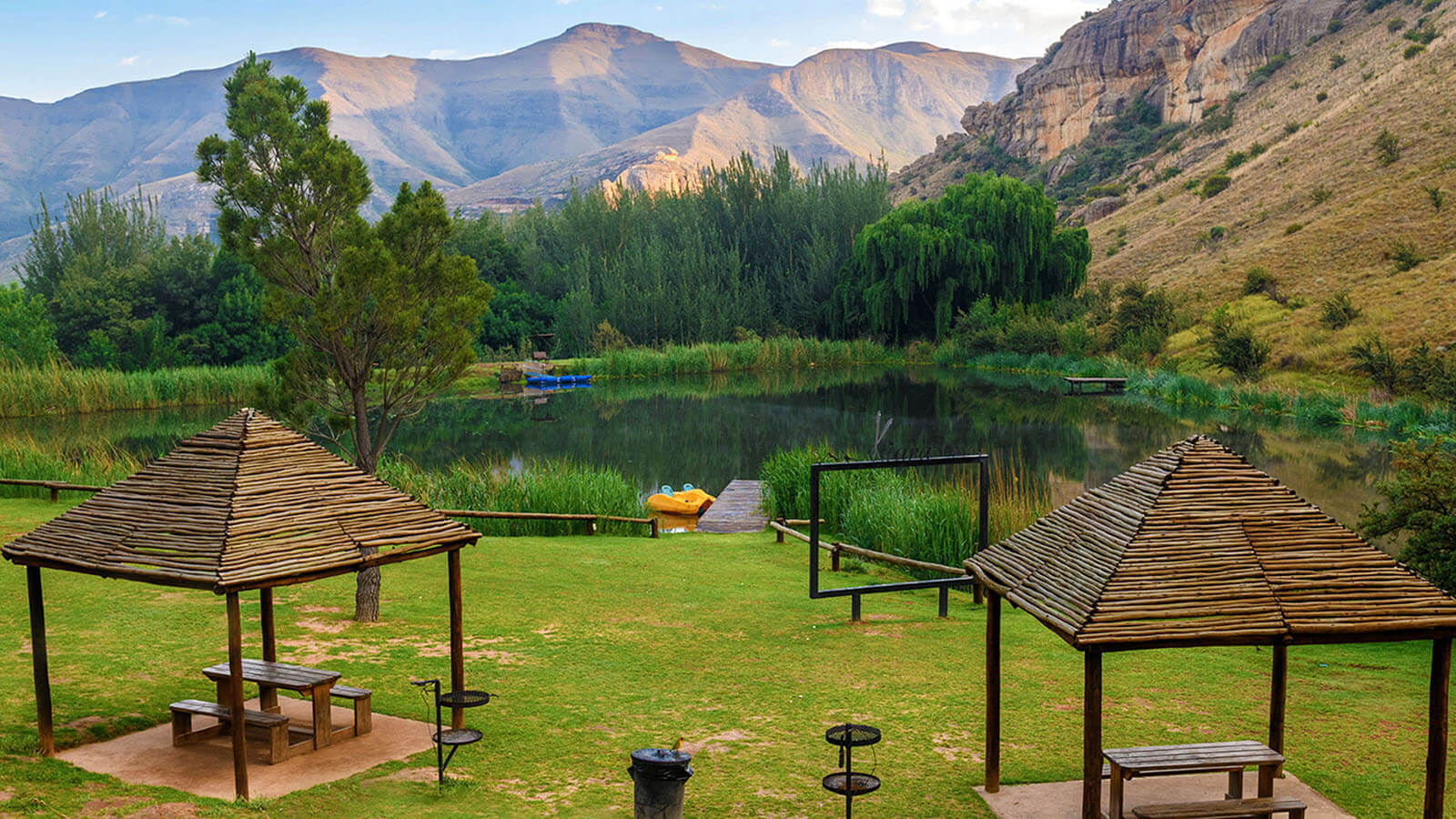
Kiara Lodge
On the R712 between Clarens and Golden Gate, with self-catering stays and family-friendly resort facilities.
Check availability on Expedia ↗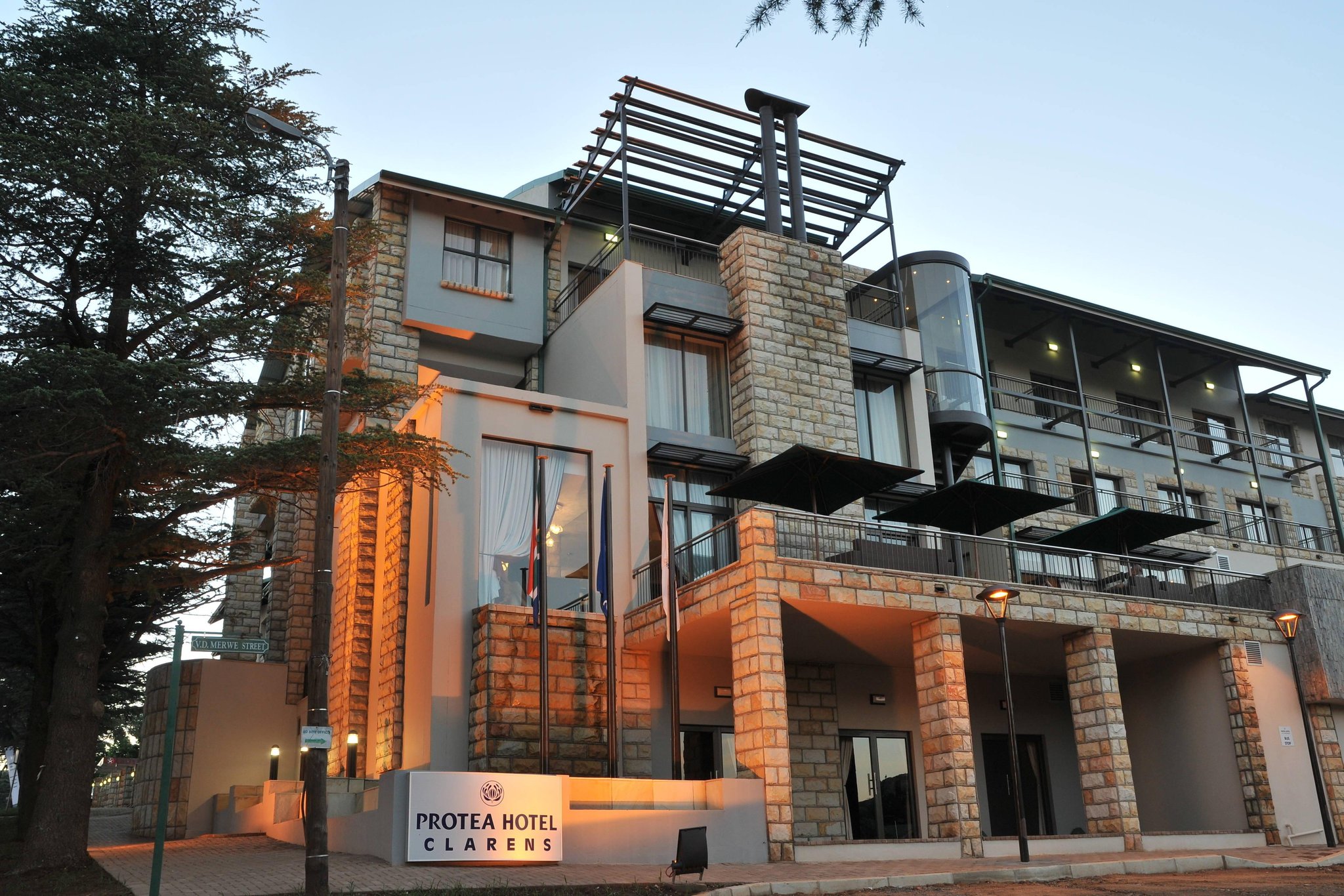
Protea Hotel by Marriott Clarens
A convenient Clarens hotel for dining and village amenities after day trips to Golden Gate.
Check availability on Expedia ↗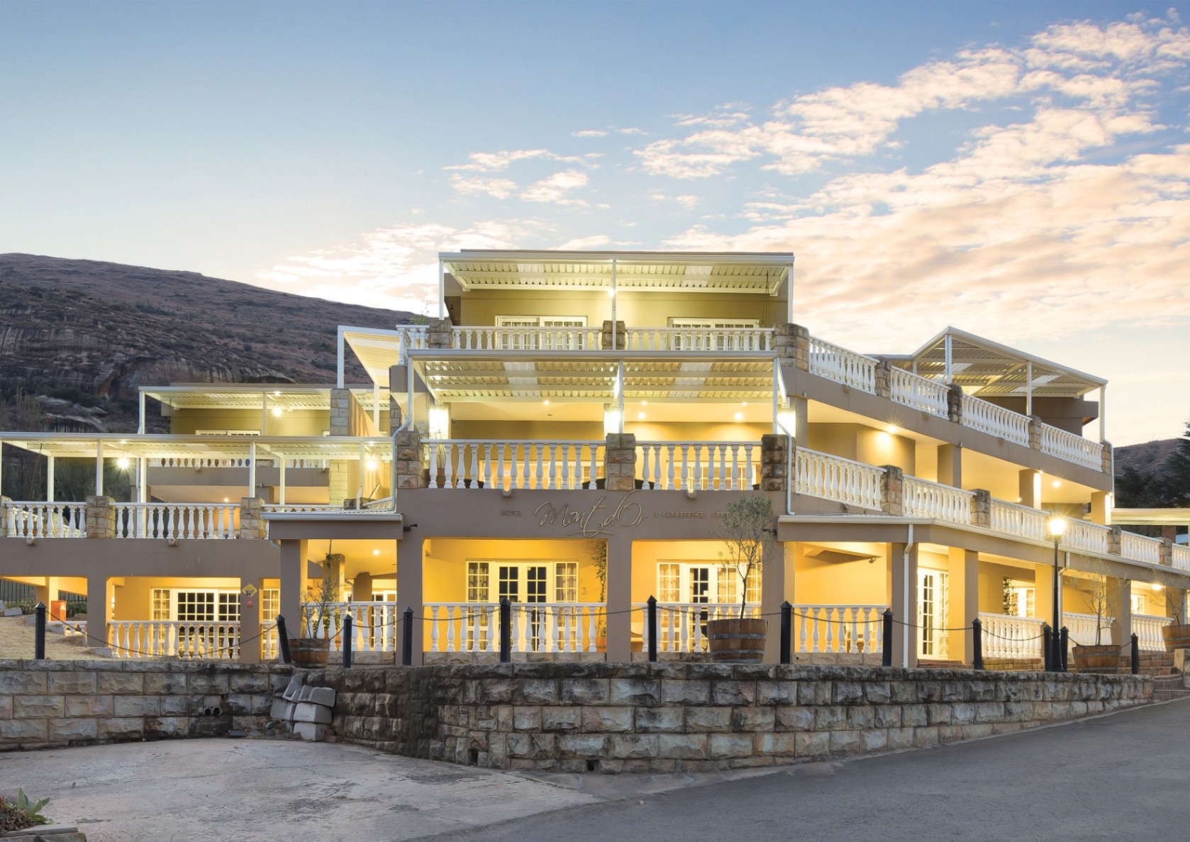
Mont d’Or Clarens
A scenic Clarens hotel with a spa, well suited to a relaxing weekend alongside park walks.
Check availability on Expedia ↗Prefer to sleep inside the park? Check SANParks accommodation for Glen Reenen Rest Camp, Highlands Mountain Retreat and other facilities. Confirm the current status of Golden Gate Hotel directly with SANParks; an Expedia listing shows a temporary closure.
Affiliate disclosure: see.africa may earn a commission if you book through Expedia, at no extra cost to you. Check current prices, room details, travel times and park fees before booking.
Golden Gate Highlands mammals to look for
The grassland antelope deserve close attention. Compare larger herds on open ground with smaller slope specialists, using binoculars before deciding an area is empty. Oribi, rhebok and reedbuck can be concealed by grass or the shape of a hillside. Keep your distance on walks and never leave a route to approach a resting animal or its young.

Black wildebeest
A white tail, dark coat and forward-curving horns distinguish this open-grassland grazer from blue wildebeest. Watch herd spacing and display behaviour from the road. The contrast between pale tail and dark body often remains visible at quite a distance.
_(31746882054).jpg)

Blesbok
A white face blaze and brown body characterise this grassland antelope. Both sexes carry ringed horns. Notice group size and feeding patterns, and distinguish it from bontebok using location and the full rump and leg pattern rather than one facial mark.
.jpg)

Common eland
Africa’s largest antelope has a deep body, a dewlap and gently spiralling horns. Its size does not prevent it from moving gracefully through open woodland. Watch mixed-age groups at a respectful distance and distinguish it from buffalo by its lighter build and horn shape.


Red hartebeest
An elongated face, high shoulders and angular horns give this reddish antelope a distinctive silhouette. Compare its body shape with nearby wildebeest or blesbok. A standing lookout may reveal a group concealed in a fold of the grassland.


Springbok
The dark flank stripe, pale face and white rump stand out against dry grassland. Groups can rest almost invisibly during the hottest hours. Watch their heads and ears for alert behaviour and allow animals to cross the road without splitting the herd.


Oribi
A small, slender antelope with a long neck and upright ears. It can remain nearly invisible in tall grass, then appear briefly on a slope. Use binoculars and stay on the approved route; approaching through grass can disturb a resting animal or concealed young.


Grey rhebok
A woolly grey coat, long ears and a fine, upright posture suit a highland antelope that can blend into muted slopes. Males carry slender straight horns. Scan rocky grassland slowly; movement often reveals an animal before its outline becomes clear.
_male_at_Karoo_NP,_Western_Cape,_South_Africa.jpg)

Mountain reedbuck
This small reedbuck favours suitable grassy slopes and broken ground. The pale belly, grey-brown back and curved horns of males are useful clues. Look for a quiet group above the road rather than expecting it beside a river like every other reedbuck.
_(33043612376).jpg)

Steenbok
A small reddish antelope with large ears and a pale underside. Individuals often stand still near low cover and can disappear after only a few steps. Stop gently and observe from the road instead of driving toward the spot where one hid.
.jpg)

Chacma baboon
A long muzzle and substantial build identify this southern African baboon. Troops forage widely and readily investigate unsecured food. Keep doors, windows and picnic bags closed; never feed an animal or display food to attract it for a photograph.
_(16824823063).jpg)
Golden Gate Highlands birds and habitat clues
Mountain airspace, grassland and flowering slopes support a varied birding visit. Bearded vulture is a scarce specialist target rather than a routine sighting. The authorised vulture hide is a visitor facility, not permission to find breeding sites or leave food yourself. Watch weather, light and natural flight conditions while also making time for smaller birds close to the permitted route.

Bearded vulture
Long pointed wings and a wedge-shaped tail distinguish this scarce mountain raptor. A distant bird needs careful comparison with eagles and other vultures. Good views are far from guaranteed; watch suitable mountain airspace and respect restrictions around breeding habitat.
_Photo_by_Giles_Laurent.jpg)

Cape vulture
A large, pale-bodied vulture whose broad wings make an impressive shape against mountain skies. Wind and rising warm air influence when birds soar. Observe from authorised viewpoints without approaching breeding ledges or disturbing resting birds.
_1.jpg)

Verreaux’s eagle
A large dark eagle associated with rocky landscapes. Adults show a pale back marking and contrasting wing panels, although distance and strong backlight can hide them. Watch the shape and soaring pattern with binoculars. Cliff nesting birds should be observed from public routes without approaching ledges.
,_Aquila_verreauxii,_at_Walter_Sisulu_National_Botanical_Garden,_Gauteng,_South_Africa_(28825027073).jpg)

Jackal buzzard
This broad-winged southern African raptor often uses slopes and uplift. Adults can show rich chestnut on the chest and tail, though distance and light complicate identification. Study several features together and compare with other buzzards before naming a silhouette.


Blue crane
Pale blue-grey plumage and long trailing wing feathers distinguish South Africa’s national bird. Watch pairs or groups feeding in open country with binoculars. Stay away from nests and young, and never drive off the road for a closer view.


Secretarybird
A very long-legged raptor that hunts on foot through open grass. Its crest and long tail are useful at distance. Watch a walking bird with binoculars and leave its path clear; following closely can disrupt the search for prey.


Malachite sunbird
Breeding males have brilliant green plumage and a long tail; females and non-breeding birds require a more careful look. Flowering slopes can be productive. Avoid confusing a flash of green with a complete identification, particularly when several sunbirds share a patch.


Cape bunting
A striped face, warm wing tones and seed-eating bill identify this bunting of suitable rocky and open habitats. Watch the ground around a natural perch. Small birds often reveal themselves through repeated short movements rather than an obvious long flight.

Golden Gate Highlands plants and habitats
Highland grassland
Grass height, burning history and rainfall shape the visible landscape. Open feeding patches and taller refuge support different animal behaviour, so avoid treating the slopes as empty space between cliffs.
Sandstone cliffs and ledges
Rock structure and small soil pockets influence plant communities. Stay away from unstable edges and leave ledges undisturbed for wildlife and plants.
Sheltered ravines
Moister, protected ground contrasts with exposed slopes. A change in vegetation along an authorised walk can explain why birdlife changes over a short distance.
Flowering mountain plants
Seasonal blooms add colour beyond the famous cliff light. Photograph from the path and avoid picking flowers or trampling plants to arrange a picture.
Geology and fossils
Interpretation helps connect the sandstone landscape with a much older history. Never remove fossils or damage rock surfaces; use the park’s centre and guided information.
Plant identification may require leaves, flowers, fruit and a knowledgeable guide. Do not collect plants or leave authorised routes to inspect them.
What can you do in Golden Gate Highlands?
Walk beneath the sandstone
Choose a suitable open route and allow time to look at texture, shape and changing light. A short walk can be a complete outing rather than a consolation for not climbing higher.
Visit Kgodumodumo
The dinosaur centre adds context and a useful option when mountain weather limits walking. Check current tickets and any eligibility linked to an overnight park booking.
Arrange a cultural visit
Confirm the Basotho Cultural Village programme directly and approach it as interpretation by people with their own living traditions. Ask permission before photographing individuals.
Watch from the vulture hide
Use the authorised facility, keep quiet and let natural bird movements determine the experience. No particular species or feeding event should be assumed.
Rules and practical precautions
Complete the required visitor reporting and fee arrangements even though the through-road has no closing gates. Stay on marked, open trails and adjust plans for thunderstorms, mist, cold and exposure. Leave fossils, plants and cultural material untouched. Refuel outside the park while the Glen Reenen closure remains listed, and confirm current route information for remote accommodation.
Give wildlife space
Never feed, surround or block an animal. Keep food secure, voices low and movements predictable. Your guide or ranger’s instructions take priority over a desired photograph.
Prepare for your actual activity
Bring water, sun or rain protection as appropriate, suitable footwear and charged equipment. Tell the operator about relevant mobility needs before booking so the route and vehicle can be matched to you.
Official sources · checked 9 September 2026: SANParks: Golden Gate Highlands National Park overview · SANParks: current visitor notices. Confirm arrangements for your travel date.
Golden Gate Highlands travel FAQ
Is Golden Gate suitable for families?
Yes, when walks and activities match the group’s abilities. Scenic drives and dinosaur interpretation can complement shorter outdoor routes.
Does the park road close at night?
SANParks says the public through-road has no closing gates. Reception, attraction and trail arrangements still apply separately.
Can I buy fuel at Glen Reenen?
The SANParks notice reviewed on 9 September 2026 lists the filling station as closed until further notice. Refuel outside the park.
What are the international conservation fees?
For 1 November 2025–31 October 2026, SANParks lists R325 per adult and R163 per child aged 2–11 per day. Separate attractions may have additional charges.
Are bearded vultures guaranteed?
No. They are scarce mountain birds. Use authorised viewpoints and the hide without approaching nests or disturbing birds.
How many nights should I stay?
Two or three nights allows walks, scenic drives and interpretation, with flexibility for mountain weather.
Sources, method and review date
This guide combines official park and operator information with editorial planning advice. Operational details were checked on 9 September 2026. Season descriptions are typical patterns, and suggested stays are planning recommendations. Wildlife profiles explain identification and habitat; they do not promise sightings.
Wildlife and image references
Species names and identification photographs were checked against the linked reference and image records. Photographs are identification examples and may have been taken elsewhere. Each image carries its own creator and licence credit.
Species reference links
Black wildebeest · Blesbok · Common eland · Red hartebeest · Springbok · Oribi · Grey rhebok · Mountain reedbuck · Steenbok · Chacma baboon · Bearded vulture · Cape vulture · Verreaux’s eagle · Jackal buzzard · Blue crane · Secretarybird · Malachite sunbird · Cape bunting