
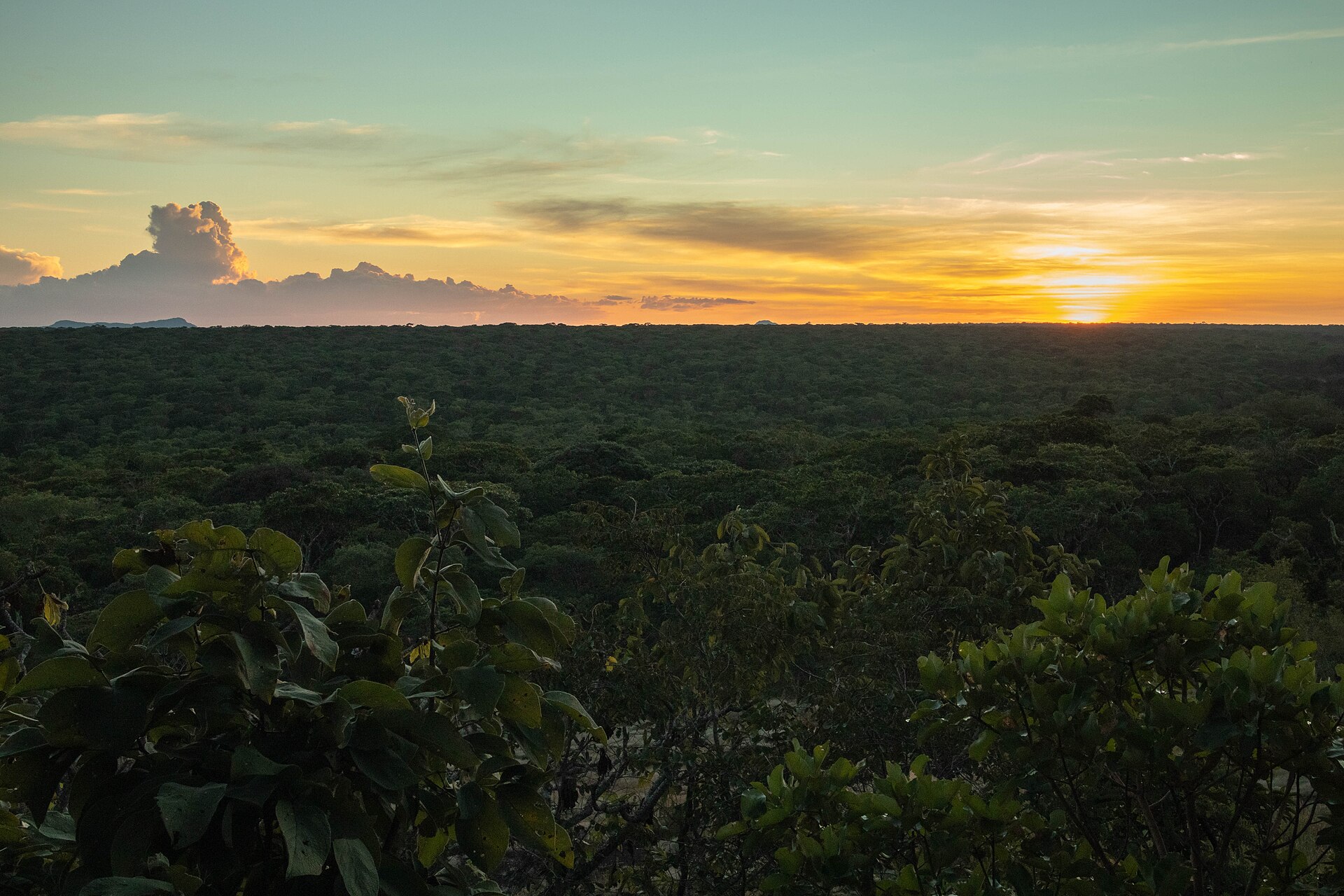
North Luangwa National Park Guide: Map & Self-Drive (2026)
North Luangwa is Zambia at its wildest: a 4,636 km² national park with low visitor traffic, black rhino conservation, walking safaris and the new Amatololo self-drive experience along the Lufila and Luangwa rivers.
Information checked 8 September 2026
Is North Luangwa National Park worth visiting?
Yes—especially if you want remoteness rather than a high-density game-viewing circuit. Zambia Tourism describes North Luangwa as a 4,636 km² wilderness with strong buffalo, predator and elephant populations, plus a stable black rhino population inside a tightly protected Special Protection Zone. The North Luangwa Conservation Programme now also supports a low-impact self-drive product, the Amatololo Experience, which opens part of this formerly difficult-to-access park to properly prepared independent travellers.
Quick Answers
Freshness fact: the current North Luangwa tourism platform describes the park as part of a roughly 30,000 km² protected landscape including surrounding Game Management Areas. The conservation programme is a partnership involving Zambia’s Department of National Parks and Wildlife and Frankfurt Zoological Society.
What is the best time to visit North Luangwa?
For most travellers, July to October is the safest planning window. Zambia Tourism says operators generally conduct safaris from June to October, while wet-season access from roughly November to May can become virtually impossible because of black-cotton soils, dirt roads and swollen waterways. The Amatololo tourism platform gives a more specific self-drive window of July to mid-November, subject to rainfall.
| Period | What it is like | Best for | Planning note |
|---|---|---|---|
| June | Drying out; some camps begin operating | Walking camps, early dry-season landscapes | Verify route conditions before committing to a self-drive loop |
| July–August | Cooler, dry, increasingly concentrated wildlife | Self-drive, walking, camping | Excellent all-round window |
| September–October | Hotter and very dry | River-focused game viewing, predators, large herbivore concentrations | Carry more water and plan heat carefully |
| November–May | Rains and difficult soils | Not the standard independent travel season | Many roads become unsuitable or impassable |
What are the North Luangwa park fees in 2026?
The most recent fee table published by Zambia Tourism is explicitly labelled 2025, so See.Africa does not present it as a confirmed 2026 tariff. That official reference lists North Luangwa at K44.80 for Zambian citizens, US$15 for residents/SADC nationals, US$20 for international visitors and US$25 for self-drivers, per person per day. It also lists separate vehicle and activity charges. Use those figures only as a planning reference and confirm the live amount at Mano Gate or with the Department of National Parks and Wildlife before travel.
Checked 8 September 2026 against Zambia Tourism’s official park-fee page. That page states that its table is for 2025 and that fees may change without notice.
How do you get to North Luangwa National Park?
The simplest independent road approach is via Mpika and Mano Gate. Zambia Tourism instructs drivers to leave the Great North Road about 60 km north of Mpika (roughly 28 km south of Shiwa Ng’andu), follow the signed track about 32 km to Mukungule village, turn left at the T-junction and continue about 12 km to Mano Gate. At the gate you can sign in, pay fees, obtain current conditions and pick up a map.
For guided fly-in safaris, the official North Luangwa tourism site says charter flights can be arranged from Lusaka, Mfuwe or Mwanya to Mwaleshi Airstrip. Mwaleshi and Takwela camps operate seasonally and are oriented strongly toward guided walking and low-volume wilderness travel.
Which North Luangwa experience should you choose?
| Option | Best for | Arrival | Key planning point |
|---|---|---|---|
| Amatololo self-drive | Experienced 4×4 travellers | Mano Gate / designated route | Self-sufficient camping; book campsites; no shops or fuel inside |
| Mwaleshi walking safari | Walking-first safari | Charter to Mwaleshi Airstrip | Seasonal operation; guided experience |
| Takwela | Walking + some broader riverine exploration | Mwaleshi Airstrip then transfer | Remote, seasonal and guided |
| Community camps | Lower-cost buffer-zone access | Road access via adjoining GMAs | Useful before/after the self-drive loop |
North Luangwa map: gates, campsites, river points and safari planning
The map uses exact public coordinates where the North Luangwa Conservation Programme or another named public source publishes them. Older or broader orientation points are labelled as approximate. It is not turn-by-turn navigation. Follow current park maps, signage, ranger instructions and campsite booking information.
Marker language: 🚪 gate / ✈ airstrip / ⛺ public campsite / 🛏 camp / 🔭 viewpoint / ≋ water or river feature / ℹ orientation. Restricted wildlife locations are intentionally not mapped.
How should you plan the Amatololo self-drive loop?
Do not treat North Luangwa like a fast transit park. The official itinerary recommends slow travel, tea breaks and time at viewpoints. The four rustic self-drive campsites—Lufila Falls, Nkholo, Muzungwe and Mushika—are deliberately simple and unmanned. Zambia Tourism says they have hand water pumps and long-drop toilets, but visitors should be self-sufficient.
What should be in the vehicle?
Carry enough fuel for the complete route plus contingency, drinking water, food, two usable spare-wheel solutions where practical, tyre repair and inflation equipment, recovery gear appropriate to your vehicle, a paper/official park map, offline maps, first-aid supplies and a method of emergency communication suited to remote travel. Trailers are not recommended for travellers intending to cross the pontoon according to the official North Luangwa tourism site.
Which mammals can you see in North Luangwa?
North Luangwa supports a classic Luangwa Valley mammal community, but sightings can feel less predictable than in busier parks because animals are less accustomed to tourist vehicles. Patience is part of the experience. The profiles below describe realistic habitat and identification context rather than promising sightings.
Loxodonta africana
Common in the wider ecosystem. Look along riverine woodland and water-dependent routes; give herds generous space.
Syncerus caffer
A signature North Luangwa mammal, sometimes forming very large herds in the dry season.
Diceros bicornis
Present following successful reintroduction. Locations are sensitive; visitor access to the SPZ is restricted.
Panthera leo
Strong predator presence, often associated with buffalo-rich areas and riverine game concentrations.
Panthera pardus
Secretive; look for spoor and signs in riverine woodland and denser cover, especially on guided walks.
Lycaon pictus
Wide-ranging and never guaranteed. Packs can move rapidly across large parts of the ecosystem.
Crocuta crocuta
Regular predator and scavenger; tracks and calls are often more noticeable than daylight sightings.
Hippopotamus amphibius
Concentrated along the Luangwa and larger river pools. Treat riverbanks cautiously after dark.
Giraffa camelopardalis thornicrofti
A Luangwa Valley specialty. Look in mixed woodland and open riverine areas; distribution is localized.
Equus quagga crawshayi
The local zebra form, with narrow striping extending strongly down the legs.
Connochaetes taurinus cooksoni
A Luangwa endemic subspecies associated with open grassland and alluvial plains.
Kobus vardonii
Very characteristic of the Luangwa system; often seen in open grassy areas near water.
Aepyceros melampus
Common woodland-edge antelope and an important prey species.
Tragelaphus strepsiceros
Best searched for in broken woodland and thickets; males are unmistakable with spiral horns.
Kobus ellipsiprymnus
Usually near permanent water and riverine vegetation; the pale rump ring is conspicuous.
Tragelaphus scriptus
Shy, solitary antelope of dense riverine cover, often easier to detect early or late in the day.
Phacochoerus africanus
Look around open ground, grazing lawns and water; often trots away with tail upright.
Papio ursinus
Social troops use woodland, river corridors and rocky or elevated sleeping areas.
Chlorocebus pygerythrus
Often around riverine trees and camp areas; never feed them.
Tragelaphus oryx
Less predictable than puku or impala; favours woodland and more open country in the broader landscape.
Which birds should you look for?
North Luangwa combines river, lagoon, mopane, miombo and escarpment habitats. That mix produces both classic Luangwa birds and species with stronger East African affinities.
Merops nubicoides
Seasonal colonies use sandy riverbanks; watch aerial feeding over rivers and floodplains.
Merops boehmi
A sought-after regional species of woodland and edges; smaller and more compact than carmine bee-eaters.
Macronyx croceus
Associated with grassland; yellow underparts and black breast band are key field marks.
Plocepasser rufoscapulatus
A specialty noted from the northern Luangwa region; look for groups in open woodland.
Haliaeetus vocifer
Commonly associated with the Luangwa River and larger lagoons; the ringing call carries far.
Bucorvus leadbeateri
Large terrestrial hornbill of open woodland and grassland, often in family groups.
Ephippiorhynchus senegalensis
Search lagoons, shallows and river margins; one of the valley’s most conspicuous wetland birds.
Vanellus albiceps
Strongly linked to major rivers, sandbars and islands.
Agapornis lilianae
Small green lovebird; scan fruiting woodland and water points for fast-moving flocks.
Scotopelia peli
Rare and difficult, but mature riverine forest is appropriate habitat. Best sought with an experienced guide.
What plants and habitats define North Luangwa?
The park is not one uniform woodland. Riverine forest, mopane, miombo, alluvial grasslands, escarpment vegetation, lagoons and river channels create the habitat mosaic that makes the wildlife so diverse.
Trees & shrubs
Colophospermum mopane
Dominant in many hot, clay-rich areas; butterfly-shaped leaves are distinctive.
Faidherbia albida
Important riverine tree; Mushika is described officially as overlooking Faidherbia woodland.
Diospyros mespiliformis
Large shade tree associated with riverine habitat; Nkholo is known for deep ebony shade.
Kigelia africana
Common near rivers; huge hanging fruits make it easy to identify.
Combretum imberbe
Long-lived, heavy-wooded tree of savannah and drainage-line environments.
Senegalia nigrescens
Recognizable by dark knobbed thorns; supports browsers and nesting birds.
Sclerocarya birrea
Fruit-bearing savannah tree used by elephants and many other animals.
Adansonia digitata
Scattered iconic trees in hotter woodland; swollen trunks store water.
Brachystegia & Julbernardia spp.
On suitable higher, better-drained ground, miombo woodland adds a very different structure from the Luangwa riverine belt.
Combretum spp.
A useful field category where exact species ID requires leaves, flowers or fruit.
Grasses, reeds & understory
Grow on seasonally inundated ground and become important dry-season grazing.
Hyparrhenia spp.
Tall grasses common in seasonally burned savannah and open woodland.
Panicum spp.
Productive grasses in damper or alluvial sites; valuable graze after flood recession.
Dense reed margins shelter birds, amphibians and smaller mammals around slow water.
Cyperus spp.
Common around wet edges and lagoons; identification to species often needs close botanical inspection.
Nymphaea spp.
Occur in suitable still-water habitats and provide cover for aquatic organisms.
Termite mounds often support denser or compositionally different vegetation from surrounding woodland.
Seasonal herbs and grasses respond strongly to fire and rainfall below Brachystegia-Julbernardia woodland.
Short-lived plants colonize exposed sand and silt as water levels fall.
Mwanja and Muzungwe-type lagoons support wetland grasses, sedges and aquatic plants important for birding.
Plant identification caution: exact species can be difficult outside flowering or fruiting periods. Treat habitat-level identification as more reliable than guessing a species from leaves alone.
What are the best things to do in North Luangwa?
What safety rules matter most?
- Stay on permitted roads. Do not leave the transit road inside the Special Protection Zone or attempt to locate rhino.
- Book campsites. Official guidance says one booking per site is used to preserve solitude and low impact.
- Be self-sufficient. There are no shops or fuel stations in the park.
- Give wildlife space. North Luangwa animals may be less habituated to vehicles than those in higher-traffic parks.
- Treat rivers carefully. Hippos and crocodiles make unsupervised river-edge activity dangerous.
- Check current road and pontoon conditions. Rainfall can change accessibility quickly.
- Follow ranger and operator instructions. They override approximate online maps and general planning guidance.
North Luangwa FAQ
Can I visit North Luangwa without a tour?
Yes. The Amatololo Experience now supports properly prepared independent self-drivers on designated roads outside the restricted SPZ, with booked rustic campsites.
Do I need a 4×4?
For the Amatololo route, a capable 4×4 is the sensible baseline. The route is remote, seasonal and includes rough tracks; current conditions should be checked before entry.
Can I see black rhino?
Black rhino occur in North Luangwa following a major reintroduction and protection programme, but access to their Special Protection Zone is limited. The guide intentionally does not publish rhino-location markers.
When does the Amatololo loop open?
The official North Luangwa tourism site says July to mid-November, rains dependent. Do not assume a fixed annual opening date.
Where can I buy fuel or food?
Not inside North Luangwa National Park. Zambia Tourism explicitly warns that there are no filling stations or shops in the park.
Which campsite is best for birding?
Muzungwe is an obvious choice because its official description emphasizes the lagoon and aquatic birdlife. Nkholo and Mushika are stronger river-oriented alternatives.
Is North Luangwa better than South Luangwa?
They suit different travellers. South Luangwa is easier and has a much larger tourism infrastructure; North Luangwa is better for solitude, specialist walking and remote self-drive adventure.
How this guide was checked
See.Africa checked time-sensitive access, campsite, season, fee and route information against current first-party or official tourism sources on 8 September 2026. Exact campsite and route-point coordinates are used only where a named public source provides them. Older orientation points are labelled approximate. Current Department of National Parks and Wildlife, ranger, gate and operator instructions always override online guidance.
Primary sources and live checks
- North Luangwa Conservation Programme — official tourism and conservation platform
- North Luangwa Conservation Programme — Amatololo Loop, campsites and community camps
- North Luangwa Conservation Programme — official route itinerary/map
- Zambia Tourism — North Luangwa National Park
- Zambia Tourism — official park fee reference (labelled 2025)
- Frankfurt Zoological Society — North Luangwa Conservation Programme background and black rhino recovery
Continue planning with See.Africa’s National Park Guides, South Luangwa guide, Kasanka guide, Kafue guide and Lower Zambezi guide.