
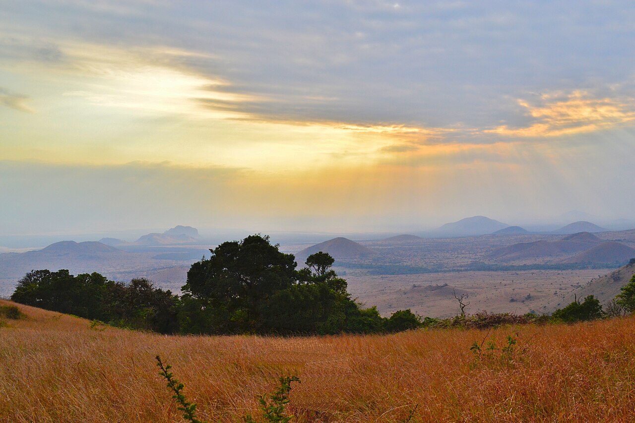
Chyulu Hills National Park Guide
Discover Kenya’s green volcanic hills: when to visit, caves, walking safaris, wildlife, maps, access and where to stay.
Chyulu Hills photograph: Sho Hatakeyama, via Wikimedia Commons (CC0 1.0).
Chyulu Hills National Park at a glance
Chyulu Hills is a volcanic highland national park in southern Kenya known for green ridges, lava tubes, forest birding and ranger-guided hikes. The park is better for landscapes and nature walks than guaranteed large-animal sightings.
Quick Answers
Visitor logistics checked against Kenya Wildlife Service on 10 October 2026; verify before travel.
When is the best time to visit Chyulu Hills National Park?
June to October and January–February are generally practical drier-weather planning windows for hiking and views. Mornings may still be misty, and green slopes can be wet even outside the main rains. April–May often brings heavy rain; November–December is commonly greener but less predictable for minor tracks. Ask a local guide about conditions rather than assuming the weather in nearby Kibwezi reflects that on the ridges.
For volcanic scenery
Arrive early for changing cloud and light. A misty morning is atmospheric but may hide distant summits.
For caves and hiking
Book ranger-guided activities in advance. Rain can make volcanic rock, slopes and cave entrances slippery.
For birds
Forest-edge listening stops can be productive year-round, with different calls and visibility by season.
For access
Wet tracks may need a high-clearance 4×4 or cancellation. Confirm the actual route and last safe return time.
Typical climatic pattern, not a live forecast or guarantee of track conditions.
Chyulu Hills entry fees and gate hours (2026)
Kenya Wildlife Service currently lists the following rates. Always reconfirm on the live official page or KWS eCitizen before paying. Separate vehicle, camping or activity charges may apply.
| Category | Adult | Child |
|---|---|---|
| East Africa citizen | KES 500 | KES 250 |
| Kenya resident | KES 675 | KES 350 |
| Other African citizen | USD 20 | USD 10 |
| Non-resident | USD 40 | USD 20 |
Official source checked 10 October 2026: KWS Chyulu Hills visitor information.
How to reach Chyulu Hills: Kithasyo, Kibwezi and air access
KWS describes the primary approach via the Kibwezi/Manyanga turnoff from Mombasa Road, with a roughly 9 km approach to Kithasyo Gate. Check the latest directions before leaving the main highway. Remote tracks need appropriate transport and local arrangements.
| Access | Good for | Planning note |
|---|---|---|
| Kithasyo Gate | First visit and park HQ | Confirm entry, permits and guide |
| Kisula area | Lava caves | Arrange guide, permissions and lights |
| Satellite campsite | Remote camping | Check track, water and ranger access |
| Kithasyo/Mukururo airstrips | Pre-arranged charter access | Not scheduled passenger services |
KWS also describes onward access via Kibwezi rail services. Verify train stops, ground transfers and airstrip permissions before booking. Bring water, fuel, charged communications and offline directions.
Source checked 10 October 2026: KWS Chyulu Hills.
Chyulu Hills interactive map: caves, camps and access
Explore approximate orientation points on this OpenStreetMap-based map. These are not turn-by-turn navigation instructions or verified hiking routes. Official signposts and ranger instructions take priority.
Loading interactive map…
Map data © OpenStreetMap contributors. The optional access plan highlights a sequence, not a road line. Some map points are regional context outside the park, including Tsavo West.
All 15 mapped locations (including approximate coordinates)
- Kithasyo Gate (approx.) — OSM orientation point. Verify on site.
- Kithasyo park HQ — OSM orientation point. Verify on site.
- Kithasyo campsite — OSM orientation point. Verify on site.
- Kisula Caves — OSM orientation point. Verify on site.
- Satellite campsite — OSM orientation point. Verify on site.
- Kithasyo airstrip vicinity — OSM orientation point. Verify on site.
- Chyulus aerodrome — OSM orientation point. Verify on site.
- Ol Donyo Lodge — OSM orientation point. Verify on site.
- Chyulu ridge vicinity — OSM orientation point. Verify on site.
- Kibwezi town — OSM orientation point. Verify on site.
- Kibwezi Forest — Regional forest north of the park, not a public park entrance. Mapped source.
- Kikumbulyu locality — Regional road-access orientation point, not a park gate. Mapped source.
- Chyulu park area reference — Approximate park centre for geographic orientation, not a trailhead. Mapped source.
- Shetani Lava Flow in Tsavo West — Separate Tsavo West attraction; may require additional admission. Mapped source.
- Shetani eastern lava reference — Second mapped lava-flow feature in Tsavo West, not Chyulu park proper. Mapped source.
How should you plan a day or a multi-night Chyulu Hills visit?
One day from Kibwezi
Confirm Kithasyo entry and ranger arrangements; reach the park early, choose a modest viewpoint walk, picnic only at approved places, and start the return trip with daylight to spare.
Two nights: volcanic field guide
Arrive in daylight and settle at a confirmed KWS public campsite or lodge. Use one full guided day for highland scenery and another activity for wildlife, birds or an authorised cave visit.
Cave day
Check access permission, guide availability, equipment, headlamp backups and local weather. Do not enter a cave without an experienced leader.
Chyulu + Tsavo West / Amboseli
For classic wildlife viewing, use Chyulu as the scenery-and-walk component and nearby safari destinations for game drives. Confirm route, park charges and accommodation separately.
16 mammals of the Chyulu Hills and connected ecosystem
These animals occur or are reported in the park or its surrounding wildlife landscape. Many are elusive, and some are associated primarily with lower forest or savanna. This is not a guaranteed sightings list.
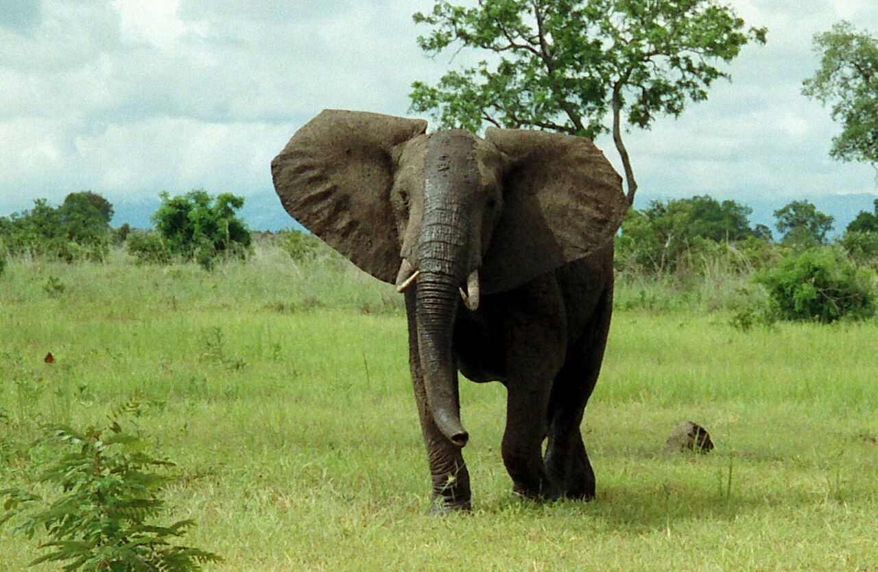
African bush elephant
Woodland and wider migration corridors; tracks are more likely than a guaranteed encounter.
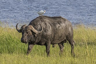
African buffalo
Thick woodland and openings; especially dangerous to approach on foot.

Masai giraffe
Browses in lower woodland and surrounding savanna, less likely along upper ridges.

Plains zebra
Open grassland and regional savanna; scan quietly with binoculars.
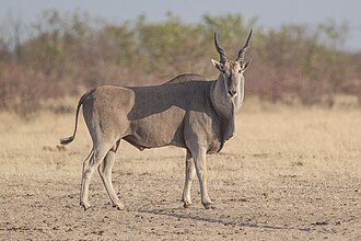
Common eland
Large spiral-horned antelope of mixed wooded grassland.
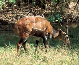
Bushbuck
Secretive forest-edge antelope; listen for alarm snorts.
Mountain reedbuck
Associated with steep grassland; watch from a distance.
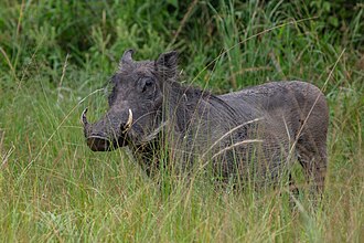
Common warthog
Open grassland and forest edges; runs with its tail raised.
Bushpig
Thicket and woodland animal, more active in low light.
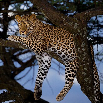
Leopard
Elusive woodland predator; very unlikely on a normal hike.
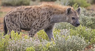
Spotted hyena
Regional grassland and woodland carnivore; calls or tracks may be more apparent.
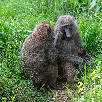
Olive baboon
Wooded areas, rocky hillsides; never offer food.
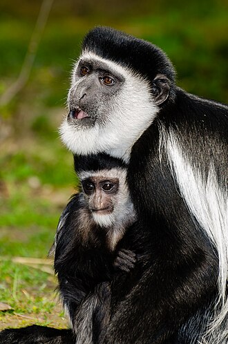
Black-and-white colobus
Forest canopy; listen for calls before scanning trees.
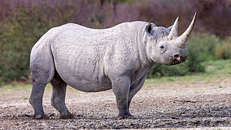
Black rhinoceros
Rare conservation species; do not seek or publish sensitive locations.
Lion
Possible in the wider connected ecosystem; rarely a hill-walking sighting.
Cheetah
Open surrounding savanna; not a realistic highland-hiking target.
Use the KWS Chyulu Hills overview for regional wildlife context; don’t pursue sensitive rhino sites.
13 birds of Chyulu Hills and nearby habitats
Forest, flowering woodland, scrub and open upland ridges support different bird communities. The following regional birding references are best used with a local checklist and knowledgeable guide; individual sightings are not guaranteed.
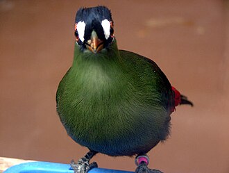
Hartlaub’s turaco
Montane canopy; distinctive calls.
White-eared barbet
Wooded forest edge; fruiting trees.
Speckled mousebird
Shrubland; long tails in noisy groups.
Trumpeter hornbill
Forest canopy; loud flight calls.
Yellow-bellied greenbul
Dense thicket and lower woodland.
Bronze sunbird
Flowering trees and forest edge.
White-starred robin
Shaded forest understory.
Orange ground thrush
Forest leaf litter; secretive.
Cinnamon bracken warbler
Dense montane vegetation; usually heard.
African crowned eagle
Mature forest and overhead canopy.

Martial eagle
Open slopes and wider savanna sky.
Ayres’s hawk-eagle
Forest airspace; uncommon.
Violet-backed starling
Woodland fruiting trees.
Chyulu Hills flora: trees, shrubs and understory
The park combines volcanic grasslands, scrub and moister mountain forest. KWS explicitly notes wild olive, African sandalwood, Acokanthera and red-hot pokers; the remaining entries describe useful regional plant-identification groups, not an exhaustive park checklist.
Trees and shrubs
Wild olive
Evergreen woody species named in KWS vegetation information.
African sandalwood
Named by KWS; protected populations should not be harvested.
Acokanthera
Toxic shrubs/trees; do not handle sap or taste.
Forest figs
Fruit attracts birds and mammals; precise species varies.
Croton
Trees of woodland and forest edges.
Vachellia thorn trees
Lower, drier slopes; identification needs leaves and thorns.
Euclea shrubs
Dry shrubland and wooded edges.
Montane forest trees
Moist highland forest canopy; ask botanist for field ID.
Flowers, ferns and understory
Red-hot poker flowers
Distinctive flower spikes highlighted by KWS.
Ferns
Shaded moist understory and forest edges.
Mosses
On humid rocks and tree trunks; avoid trampling.
Orchids
Flowering epiphytes and terrestrial plants; do not collect.
Grassland grasses
Dominant on open slopes and volcanic cones.
Sedges
Damp hollows and seasonal seepage.
Bracken
Dense patches of highland vegetation.
Lichens
Rock and bark colonisers in humid environments.
Seasonal wildflowers
Flowering displays after rain; avoid picking.
Forest seedlings
Sensitive forest regeneration in understory.
What can you do in Chyulu Hills National Park?
Guided highland hike
Explore the rolling volcanic grasslands with KWS-approved local guidance, a realistic turnaround time and adequate water.
Kisula / Leviathan lava caves
KWS highlights the region’s extensive lava-tube systems. Obtain separate guidance and access permission; the mapped cave location is not an invitation to enter independently.
Forest birding
Listen for turacos, barbets and forest species in suitable wooded sectors; arrange a guide who knows the current access.
Scenic photography
Photograph green volcanic cones, lava rock textures, cloud shadows and expansive Tsavo or Amboseli views when clear.
Approved campsite stay
KWS lists Kithasyo, Kisula and Satellite public campsites. Confirm water, toilets, fees and booking before arrival.
Geology and water catchment
Learn how permeable volcanic rock helps feed surrounding spring systems, including Mzima Springs in Tsavo West.
KWS visitor information checked 10 October 2026: official Chyulu Hills National Park page. Fees, access and regulations may change.
Where should you stay in the Chyulu Hills area?
KWS lists three public campsites: Kithasyo, Kisula and Satellite. Confirm current operations and charges. KWS also lists private safari lodges in the wider Tsavo–Chyulu circuit, but a lodge near Tsavo West does not necessarily sit inside Chyulu Hills National Park.
Kithasyo public campsite
Useful for the main-gate/HQ side. Confirm facilities, overnight entry and any ranger fees with KWS.
Kisula public campsite
Potential base for a pre-arranged lava-cave programme, subject to current site access and safety checks.
Satellite public campsite
A more remote national-park option; check availability, site approach and weather.
Ol Donyo / private conservancy stays
A higher-end option in the wider Chyulu landscape. Confirm whether listed activities occur on private conservation land or inside the KWS park.
Tsavo West lodges
KWS names Finch Hattons, Kilaguni Serena, Severin and Ngulia among regional options. Confirm exact driving route and park boundaries.
Kibwezi-side accommodation
Useful for a simpler approach from the Nairobi–Mombasa highway, but not all hotels offer organised park access.
Read the Tsavo West field guide or the Amboseli guide when building a combined itinerary.
Chyulu Hills rules and essential safety precautions
06:00–18:00 gate hours
The official Chyulu Hills KWS page lists this window for day visitors unless arrangements permit overnight stays.
40 km/h maximum on park roads
Observe KWS posted limits and do not leave designated roads or trails.
At least 20 m from wildlife
KWS specifies a minimum wildlife viewing distance; a greater distance may be necessary for animals showing stress.
No single-use plastic or feeding
KWS describes parks as plastic-free; take your rubbish away and never feed wildlife.
Cave safety
Do not enter lava tubes without authorised local guidance, appropriate helmets/lights and a safety plan.
Walking near dangerous animals
Stay with the ranger/guide; do not approach elephant or buffalo or separate from the group.
Comply with ranger instructions on entry, exit, camping, fires, quiet conduct, off-road driving and photography. Carry water and communications; ask KWS about local seasonal restrictions. Malaria protection needs tailored travel-health advice; consult the regional malaria planning guide as supplementary information.
KWS visitor information checked 10 October 2026: official Chyulu Hills National Park page. Fees, access and regulations may change.
Chyulu Hills FAQ
Where is Chyulu Hills National Park?
In southern Kenya between Tsavo and Amboseli, approached primarily through Kithasyo Gate from the Kibwezi side.
How much is entry to Chyulu Hills?
KWS lists non-resident adults at USD 40 and East Africa citizen adults at KES 500 as checked on 10 October 2026; other visitor categories differ.
When does Chyulu Hills open?
The KWS park overview lists 06:00–18:00 for ordinary day visitors, with different arrangements for approved overnights.
Can I camp in Chyulu Hills?
KWS lists Kithasyo, Kisula and Satellite public campsites. Confirm fees and facilities in advance.
Can I visit caves without a guide?
No. Use a qualified guide and verify access, gear and current rules with KWS.
What is the best time to visit?
June–October and January–February often offer more practical walking conditions; mist and rain may occur at any time.
How this guide was checked
See.Africa checked Kenya Wildlife Service information for gates, campsite options, basic opening hours, entry fees and park visitor rules on 10 October 2026. Bird and mammal profiles are regional identification aids, not sighting predictions. Map points are approximate and must be checked before travel.
See.Africa cannot guarantee that tariffs, road conditions, camp operations or access rules stay unchanged. Check current KWS guidance before booking or travelling.
Leave a Reply