

Matusadona National Park Guide
Plan Matusadona on Lake Kariba with a detailed map, Tashinga and camp advice, boat safaris, wildlife, birding, seasons and practical Zimbabwe travel tips.
Lake Kariba at sunset — regional photograph illustrating Matusadona’s lake setting. Photo: Suesen · CC BY-SA 3.0. Resized and cropped for this layout.

Matusadona National Park at a glance
Matusadona combines Zimbabwe’s safari wildlife with the immense waters of Lake Kariba. Shoreline grassland, shaded valley woodland and a rugged escarpment create a varied setting for drives, guided walks and boat trips. The journey deserves planning: road, boat and air arrivals lead to different meeting points, and a distant camp across a bay may have no simple road connection. Give a first visit at least three nights so the lake becomes part of the safari rather than merely the route to your accommodation.
Official sources · checked 8 September 2026: Visit Matusadona: official park overview · Visit Matusadona: day visitor access and activities. Confirm arrangements for your travel date.
When is the best time to visit Matusadona?
May–September is a useful first-visit window, with warm days, cooler nights and often rewarding shoreline viewing. October and November can be intensely hot, so early starts, shade and adequate drinking water become central to a comfortable day. December–April brings thunderstorms, fresh vegetation and changing access conditions. Water levels affect the shape of the shore, boat landings and the exposed grass available to wildlife; an older photograph cannot predict the shoreline you will find. A boat-based arrival may be practical when a road approach is difficult, but wind and lake conditions need their own assessment. Ask the camp which activities are operating for your dates and build in time for a revised transfer. A morning on land and a suitable afternoon on the water can reveal different aspects of the same landscape.
Typical seasonal pattern, not a forecast or a guarantee of road access. Current local conditions take priority.
Which Matusadona area suits your trip?
| Area | Best for | What to expect | Planning point |
|---|---|---|---|
| Tashinga peninsula | A practical park base | Reception-side services, camping and cottages provide a useful starting point for several activities. | Confirm whether arrival is at the harbour, road reception or airstrip. |
| Northern lakeshore | Boat-and-drive combinations | Open shore, bays and woodland edges create changing viewing opportunities. | Water levels and boat access vary; named bays are orientation references. |
| Changa and eastern shore | A specifically arranged camp stay | The eastern side gives a different base within the lake-and-park landscape. | Day arrivals at Changa harbour require prior arrangement with the park booking team. |
| Jenje and the interior | A quieter woodland and wilderness-camp focus | Inland routes offer a contrast to remaining beside the lake throughout a stay. | Use current open roads and book designated wilderness sites explicitly. |
| Escarpment and southern approach | Scenery, remote camping and specialist trekking | Rougher relief makes the journey slower and more demanding. | Separate a through-drive from an authorised trek; a viewpoint pin is not a walking route. |
| Kariba, Fothergill and nearby lake bases | Regional arrival and accommodation options | These help organise transport and a wider Lake Kariba stay. | Some properties are outside the park and have separate transfer and entry costs. |
Matusadona entry fees, permits and opening hours
A complete current entry, vehicle and activity tariff was not clearly available in the official public material reviewed. Request an itemised quote from the park reservations team or your booked lodge. Clarify person-entry categories, vehicle or boat charges, accommodation, conservation fees, guides and transfers. Fishing requires a valid permit, even when an operator provides the equipment. For a lake day trip, check whether the boat price includes landing, entry and the booked activity ashore. Confirm currency, accepted payment and cancellation terms before paying.
Official sources · checked 8 September 2026: Visit Matusadona: day visitor access and activities · African Parks: Matusadona official visitor brochure, map and rules. Confirm arrangements for your travel date.
Opening hours
The official park information permits self-driving between sunrise and sunset. Agree reporting times for boats, guided activities and arrival at your camp. An overnight booking does not authorise independent night driving.
Official sources · checked 8 September 2026: Visit Matusadona: official park overview · Visit Matusadona: day visitor access and activities. Confirm arrangements for your travel date.
How do you get to Matusadona?
Kariba town is an important meeting point for arranged boat transfers, while road visitors approach through the wider Magunje/Binga-road network and the park’s southern access. Get current directions from the park rather than following the shortest line suggested by a navigation app. Terrain, road condition and the length of the final section can make arrival slow. A boat booking needs an exact harbour, reporting time, baggage arrangement and a plan for unsuitable weather. Tashinga and other safari airstrips require confirmed flights and camp pickups; a strip marker is not evidence of scheduled service. Carry water, supplies and offline booking information, and reach the agreed meeting point in daylight. Do not assume you can cross between camps on foot along the shoreline.
Official sources · checked 8 September 2026: Visit Matusadona: official park overview · Visit Matusadona: day visitor access and activities. Confirm arrangements for your travel date.
Matusadona safari map: 26 useful places
Several campsite locations are coarse, roughly kilometre-scale estimates interpreted from the official park visitor map and aligned to published entry coordinates. These are for comparing areas; request an exact arrival pin from the park. Sources are listed for each place.
Use this map to compare bases and understand the landscape. Search by place or filter by type. All locations are approximate orientation points; current park, guide and lodge directions override the map.
Loading map near this section. All places are also listed below.
All original park points and 3 featured lodges
- Tashinga campsite and harbour · Gates & visitor centresOfficial arrival coordinate. Confirm your exact landing, camp and reception meeting point. Map source. Approximate.
- Changa harbour · Gates & visitor centresDay-visitor entry here requires prior arrangement with the park booking team. Map source. Approximate.
- Chifudze southern entrance · Gates & visitor centresOfficial southern entry coordinate. Obtain current road instructions before arrival. Map source. Approximate.
- Ume River arrival point · Gates & visitor centresOfficial transfer-entry reference, not an unsupervised crossing or public launch. Map source. Approximate.
- Rhino Safari Camp area · Camps & lodgesCoarse orientation point interpreted from the official visitor map (roughly kilometre scale). Accommodation name, not a rhino-sighting guarantee. Confirm the precise camp transfer. Map source. Approximate.
- Spurwing Island · Camps & lodgesCoarse orientation point interpreted from the official visitor map (roughly kilometre scale). Regional island accommodation reference; confirm boat transfer and park-entry inclusions. Map source. Approximate.
- Fothergill Island — outside base · Camps & lodgesCoarse orientation point interpreted from the official visitor map (roughly kilometre scale). The official visitor site identifies this base as outside the park. Arrange its own transfer and entry costs. Map source. Approximate.
- Sanyati West camp area · Camps & lodgesCoarse orientation point interpreted from the official visitor map (roughly kilometre scale). Eastern-shore accommodation reference from the official map; confirm current operation. Map source. Approximate.
- Mhukadzapera wilderness campsite · Camps & lodgesCoarse orientation point interpreted from the official visitor map (roughly kilometre scale). Designated wilderness option requiring a booking and complete self-sufficiency. Map source. Approximate.
- Shenga wilderness campsite · Camps & lodgesCoarse orientation point interpreted from the official visitor map (roughly kilometre scale). Confirm the designated site, open road and required equipment with the park. Map source. Approximate.
- Shenga wilderness platform · Camps & lodgesCoarse orientation point interpreted from the official visitor map (roughly kilometre scale). A separate mapped platform reference; agree the actual booked site with the park. Map source. Approximate.
- Maronga campsite · Camps & lodgesCoarse orientation point interpreted from the official visitor map (roughly kilometre scale). Ume-side wilderness reference. Confirm road, water and sanitation arrangements. Map source. Approximate.
- View Point campsite · ViewpointsCoarse orientation point interpreted from the official visitor map (roughly kilometre scale). Escarpment campsite and viewpoint. Remote access requires current park advice. Map source. Approximate.
- Hogwe River campsite · Camps & lodgesCoarse orientation point interpreted from the official visitor map (roughly kilometre scale). Interior wilderness site; fully self-sufficient camping by arrangement. Map source. Approximate.
- Matandare campsite · Camps & lodgesCoarse orientation point interpreted from the official visitor map (roughly kilometre scale). Southern approach camping reference. Confirm booking before using as a stopover. Map source. Approximate.
- Kanjedza airstrip · AirstripsCoarse orientation point interpreted from the official visitor map (roughly kilometre scale). Official-map aviation reference; strip operation, landing permission and pickup must be arranged. Map source. Approximate.
- Tashinga airstrip · AirstripsConfirm flight, landing permission and camp pickup. Map source. Approximate.
- Jenje Bush Camp area · Camps & lodgesCamp position may change seasonally; obtain the current operator meeting point. Map source. Approximate.
- Jenje wilderness platform · Camps & lodgesBook the designated wilderness site and confirm the exact access instructions. Map source. Approximate.
- Kariba airport — regional arrival · AirstripsRegional arrival point requiring an onward road or boat transfer. Map source. Approximate.
- Kariba tourist-information area · Gates & visitor centresRegional orientation in Kariba town, outside Matusadona. Map source. Approximate.
- Musango — regional lake base · Camps & lodgesNearby Lake Kariba accommodation outside the core park circuit; confirm transfers and entry inclusions. Map source. Approximate.
- Bumi Hills — regional lake base · Camps & lodgesWider lake accommodation reference, with separate access and booking arrangements. Map source. Approximate.
Map references include official park material where specified below, plus OpenStreetMap contributors, checked 8 September 2026. Selected and labelled by See.Africa. Waterbody-centre pins and summits are geographic references, not destinations for direct navigation. Accommodation and airstrip operation must be confirmed. No live animal locations or verified driving route is shown.
A practical Matusadona itinerary
Day 1: arrive and orientate
Complete the agreed transfer and settle at your base. If time and conditions permit, take a short local outing rather than immediately attempting a distant sector. Confirm which land and water activities suit the next two days.
Day 2: a land-and-water safari
Use the cooler morning for a drive or an authorised guided walk. In a suitable later slot, take a boat outing to appreciate the shoreline from the lake. Ask the guide to explain how water levels influence grazing and animal movement.
Day 3: choose a different habitat
Explore woodland or an inland circuit with enough time for quiet stops. A specialist birding outing can be a rewarding alternative to repeating a predator search. Keep the return margin realistic, especially from the escarpment or a distant bay.
Extra night: wilderness or a slower camp day
Add a booked wilderness site or specialist trail only with the necessary equipment and guidance. Alternatively, remain at one base and spend longer watching ordinary wildlife. A relaxed extra day also protects the trip from a changed boat transfer or difficult road.
Where should you stay in Matusadona? Our top 3 lodges
For a guided wilderness safari inside Matusadona, consider Changa or Rhino Safari Camp. For a premium lakeside lodge on a separate concession outside the park, consider Bumi Hills. Compare these with island accommodation, Jenje Bush Camp, Tashinga and Kariba gateway hotels in our Top 10 Matusadona accommodation guide.
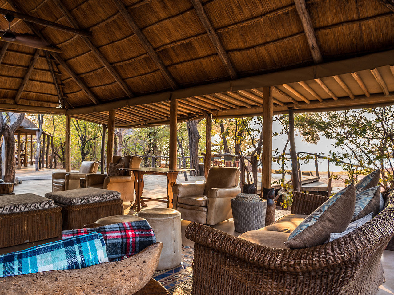
Changa Safari Camp
A tented lakeside safari camp inside Matusadona, with guided drives, walks and boat trips.
View lodge website ↗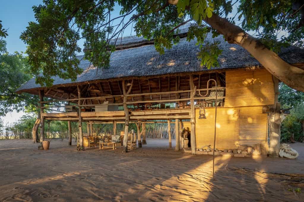
Rhino Safari Camp
A small, unfenced in-park camp for immersive wilderness experiences and guided activities.
View lodge website ↗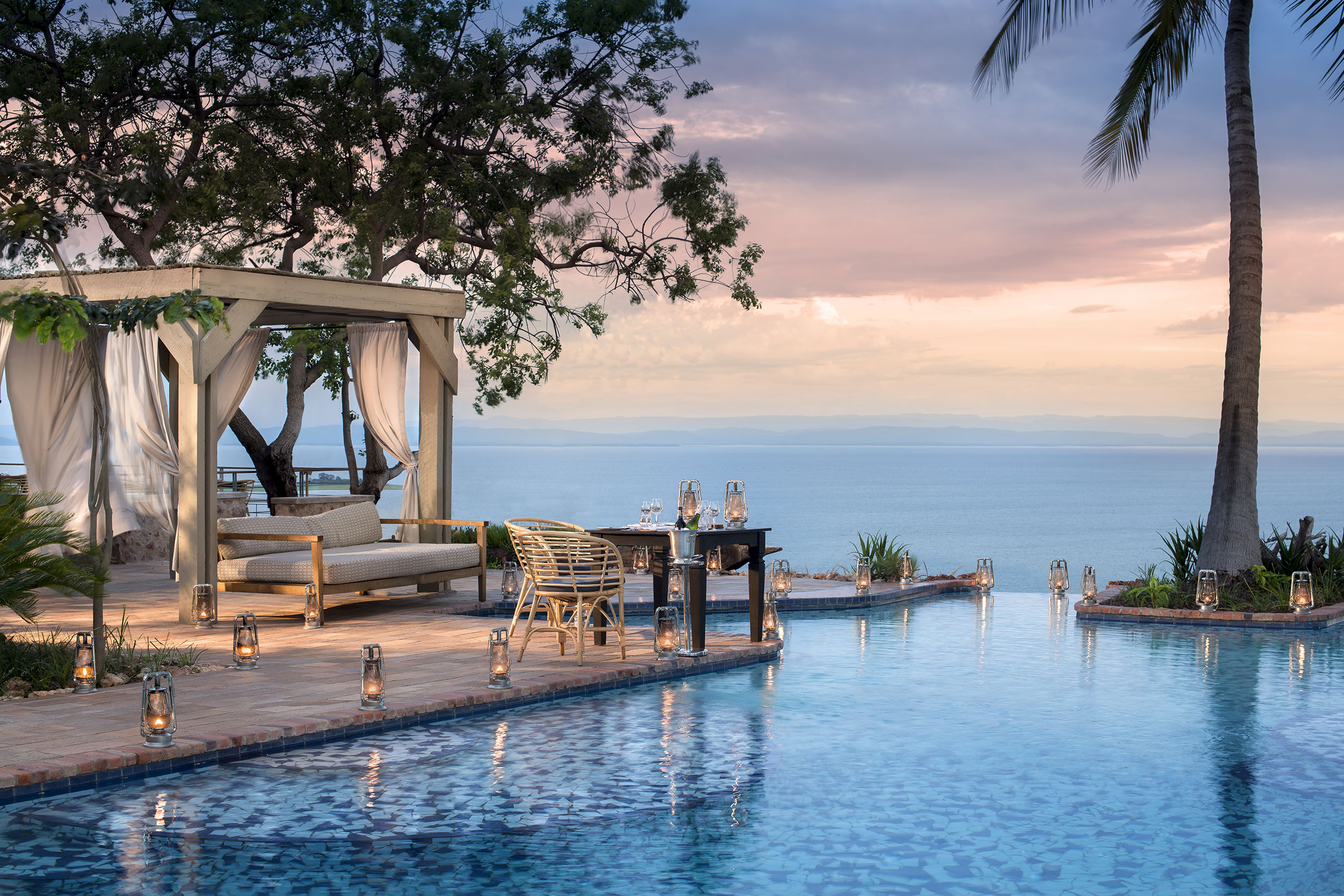
Bumi Hills Safari Lodge
A comfortable safari lodge above Lake Kariba, on a separate concession outside the park.
Check availability on Expedia ↗Compare all 10 Matusadona lodges and places to stay →
Before booking: Confirm whether boat or airstrip transfers, park entry, guiding, conservation levies and meals are included. Most lodges are not accessible like conventional roadside hotels.
Affiliate disclosure: see.africa may earn a commission on Expedia bookings at no additional cost. Changa and Rhino link directly to their operators.
Matusadona mammals to look for
Elephants, buffalo and water-associated wildlife help define the lakeshore experience, while woodland and rocky ground support a different mix of antelope. Predators are part of the park but can remain hidden for long periods. Waterbuck and hippos may be easier to encounter than a leopard, and a slow observation of either can become a highlight. These profiles span several habitats; no single drive is expected to produce the entire list.

African bush elephant
The broad ears, curved tusks and long trunk are unmistakable. Watch how a family spreads out to feed, then regroups before moving. Stop well back from the herd and leave its crossing route open; a close calf is a reason to retreat, not advance.


African buffalo
A heavy, dark bovid with a sweeping horn boss in mature bulls. Herds graze and rest together, while solitary bulls may stay close to cover. Buffalo can be difficult to read at close range: observe from the vehicle or follow your walking guide’s exact instructions.
_male_with_cattle_egret.jpg)

Lion
Lions spend much of the day resting, so search shade as carefully as open ground. Dawn and late afternoon improve the chance of movement, but a sleeping pride is a normal encounter. Listen to your guide and avoid surrounding animals with vehicles.


Leopard
Rosettes, a long tail and a powerful, low body distinguish this secretive cat. Search riverine trees, shaded rocks and dense drainage lines. A leopard can disappear in apparently thin cover; patient scanning is more useful than assuming that a radio report guarantees a sighting.
.jpg)

Hippopotamus
Ears, eyes and nostrils are positioned high on the head for a life largely spent in water. Pods may look placid, but hippos are powerful and territorial. Use designated viewpoints and guided boats; never walk between an animal and its route back to water.


Plains zebra
Look beyond the stripes: herd spacing, ears and alarm behaviour can tell you what is happening in a grassland. Foals may rest while adults stand watch. Scan the edges of a herd for predators without losing sight of the zebras’ own social interactions.


Impala
The slender body, black tail stripe and dark markings above the hind feet are useful clues. Males have lyre-shaped horns. Pause to watch bachelor groups or territorial behaviour: familiar antelope are often the best animals for learning how a safari ecosystem works.
_male_Serengeti.jpg)

Waterbuck
A shaggy coat, robust build and affinity for water are the main clues. Rump patterns differ between forms and regions. Look at the woodland–grassland boundary near rivers or lakes, where animals can graze while remaining within reach of shade and water.


Greater kudu
Large ears, narrow pale body stripes and the male’s long spiral horns help identify this woodland browser. Kudu can freeze and blend into scrub remarkably well. Scan the shady side of thickets; a pair of ears is often the first thing you notice.


Bushbuck
A medium-sized antelope that favours cover rather than open herds. Coat colour, striping and spotting vary across its range. Watch forest edges and quiet paths at first or last light; often only an ear or a brief movement betrays its presence.
.jpg)

Common warthog
Facial pads, curved tusks and a tail held upright when running make identification straightforward. Warthogs often kneel on their front legs to feed. Give burrow entrances space, and do not approach a family because the piglets appear small or playful.
,_parque_nacional_del_Lago_Mburo,_Uganda,_2024-02-01,_DD_26.jpg)

Klipspringer
A compact antelope of rocky slopes, often seen in pairs. Its specialised hooves allow precise movement over boulders. Use binoculars to inspect rocky outcrops from the road and do not climb after it; the surrounding terrain may also conceal larger wildlife.
_male_Serengeti.jpg)
Matusadona birds and habitat clues
Mix shoreline watching with woodland and open-ground stops. Fish eagles, kingfishers and larger waterbirds make a good introduction from an appropriate boat or authorised viewpoint. Pel’s fishing-owl is a specialist possibility, while raptors and grassland birds require scanning beyond the immediate shore. Birding success depends on habitat and season; do not approach a roost, heronry or nest to improve a photograph. The map deliberately avoids breeding-site detail.

African fish eagle
The white head and chest contrast with dark wings; its carrying call is a classic sound of African waterways. Scan exposed trees beside lakes and rivers. A bird returning to the same perch can offer better observation than following it in flight.
.jpg)

Pied kingfisher
A black-and-white kingfisher often seen hovering above open water before a vertical plunge. Check wires, reeds and low perches near shore. Following its feeding pattern is a useful way to watch behaviour without approaching a nest bank.
_male.jpg)

Malachite kingfisher
A tiny blue-and-orange bird that favours low perches beside water. It can disappear against reflections despite its bright colours. Scan patiently along reed edges with binoculars and remain on the permitted path or in the boat.
.jpg)

Southern carmine bee-eater
Brilliant carmine plumage and a long tail stand out when this seasonal visitor is present. It catches insects in flight and may gather near suitable feeding areas. Ask about current seasonal presence rather than expecting it on every safari.
_(16732824032).jpg)

Goliath heron
An enormous heron with a chestnut head and neck and grey wings. It often stands motionless in shallow water. Watch through binoculars and wait for a slow strike: its deliberate feeding rhythm rewards an unhurried boat or shoreline stop.
.jpg)

Saddle-billed stork
A tall black-and-white stork with a striking red, yellow and black bill. It stalks shallow water deliberately. Look along quiet margins and flooded grassland, where reflections can make a stationary bird surprisingly difficult to separate from its surroundings.


Yellow-billed stork
The yellow bill and red face contrast with a mostly white body. It often sweeps a partly open bill through shallow water while feeding. Watch water level and shoreline shape: these help explain why birds concentrate in one bay and ignore another.


Pel’s fishing owl
This large ginger-brown owl roosts in dense riverside trees and fishes mainly at night. It is a specialist target even where habitat is excellent. Use a guide who protects roosting birds, and avoid flash, playback or repeated approaches.


Martial eagle
A very large eagle with broad wings; adults have a dark upper chest and spotted pale belly. Search high perches and scan soaring raptors carefully. Size alone is unreliable, so use shape and plumage rather than a distant silhouette as proof.
.jpg)

Bateleur
A short-tailed eagle that rocks gently as it patrols. Adults show a red face and contrasting wing colours, while young birds are brown. Learn the wing shape first; backlighting can hide the features that make an adult so distinctive.
_male_Serengeti.jpg)

Grey crowned crane
The golden crown, white cheek patch and elegant grey body are unmistakable. Pairs or family parties feed in damp grassland. Watch from a distance and avoid approaching birds in breeding habitat or following chicks for photographs.
.jpg)

Secretarybird
A very long-legged raptor that hunts on foot through open grass. Its crest and long tail are useful at distance. Watch a walking bird with binoculars and leave its path clear; following closely can disrupt the search for prey.

Matusadona plants and habitats
Shoreline grassland
Exposed ground and fresh growth can attract grazers as lake levels change. The extent of a grassy bay is temporary, so an old map should not dictate how close to the water you drive.
Valley woodland
Shaded inland ground provides browse and refuge. Compare leafy cover with open shore to understand why animals can seem to disappear during the hotter part of the day.
Dense jesse bush
Thick bush can limit visibility while providing important shelter. Slow driving and listening are more useful than assuming that vegetation with few visible mammals is empty.
Escarpment woodland and rock
Steeper ground creates different vegetation, views and walking demands. A specialist trek should be planned for terrain and weather, not simply the straight-line distance to a mapped viewpoint.
River mouths and sheltered bays
The Ume, Sanyati and smaller waterways connect land and lake habitats. Their banks are ecologically important and require authorised access rather than informal picnicking at the water’s edge.
Plant identification may require leaves, flowers, fruit and a knowledgeable guide. Do not collect plants or leave authorised routes to inspect them.
What can you do in Matusadona?
Take a boat safari
Arrange an authorised operator and wear the provided flotation equipment as instructed. Use the different perspective to watch bankside birds, landscape and wildlife without crowding animals at the shore.
Book a guided walk
Walking brings tracks, plants and smaller signs into focus. Follow the designated official and do not use a map pin to begin an independent route.
Explore an inland circuit
Allow time for woodland antelope and patient scanning in shade. A circuit chosen around your base is usually more rewarding than a hurried cross-park drive.
Plan wilderness camping carefully
A remote site can be a highlight for prepared visitors. Confirm booking, route, water, sanitation, communications and fire rules before leaving the serviced visitor area.
Rules and practical precautions
The official brochure sets a 40 km/h maximum, sunrise-to-sunset driving and a maximum of three vehicles at a sighting. Off-road driving is prohibited, and walking requires a designated official. Do not use recorded calls to attract wildlife. Drones and camera traps are prohibited; firewood collection is not allowed. Camp and light fires only where authorised, and obtain a valid fishing permit.
Give wildlife space
Never feed, surround or block an animal. Keep food secure, voices low and movements predictable. Your guide or ranger’s instructions take priority over a desired photograph.
Prepare for your actual activity
Bring water, sun or rain protection as appropriate, suitable footwear and charged equipment. Tell the operator about relevant mobility needs before booking so the route and vehicle can be matched to you.
Official sources · checked 8 September 2026: Visit Matusadona: official park overview · Visit Matusadona: day visitor access and activities. Confirm arrangements for your travel date.
Matusadona travel FAQ
Where is Matusadona National Park?
It is on the southern shore of Lake Kariba in north-western Zimbabwe, with shoreline, woodland and escarpment habitats.
How many nights should I stay?
Three to four nights gives a useful first visit with time for both land and water activities and some flexibility around transfers.
Can I arrive by boat from Kariba?
Yes, through an arranged transfer. Confirm the departure harbour, weather plan and park arrival point with the responsible operator.
Can I self-drive after sunset?
No. The park’s published rule permits driving between sunrise and sunset. Follow the current instructions for any separately authorised guided activity.
Do wilderness campsites have facilities?
The official visitor information says wilderness sites require complete self-sufficiency, including water and sanitation equipment. Book the designated site and confirm current access.
Does Rhino Safari Camp mean I will see rhinos?
No. It is the name of an accommodation property. Do not interpret a camp name as evidence of a current visitor sighting opportunity.
Sources, method and review date
This guide combines official park and operator information with editorial planning advice. Operational details were checked on 8 September 2026. Season descriptions are typical patterns, and suggested stays are planning recommendations. Wildlife profiles explain identification and habitat; they do not promise sightings.
Wildlife and image references
Species names and identification photographs were checked against the linked reference and image records. Photographs are identification examples and may have been taken elsewhere. Each image carries its own creator and licence credit.
Species reference links
African bush elephant · African buffalo · Lion · Leopard · Hippopotamus · Plains zebra · Impala · Waterbuck · Greater kudu · Bushbuck · Common warthog · Klipspringer · African fish eagle · Pied kingfisher · Malachite kingfisher · Southern carmine bee-eater · Goliath heron · Saddle-billed stork · Yellow-billed stork · Pel’s fishing owl · Martial eagle · Bateleur · Grey crowned crane · Secretarybird